
Queens Tunnel Minerals
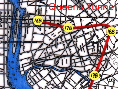
Today, sparse bedrock exposures exist in westernmost Queens where subsurface excavation of the Queens Tunnel took place between 1996 and 1999. Although now largely covered by urban structures, a few bedrock exposures still can be found west of the tunnel, in Queens. This proves that "If a tree can grow in Brooklyn – a rock outcrop can be found in Queens". Suffice to say that bedrock exposures have not been overly helpful in portraying bedrock conditions before excavation of the Queens Tunnel. A collaborative effort by (Merguerian 1999, 2000, 2001, 2002; Merguerian, Brock, and Brock 2001; Brock, Brock and Merguerian 2001; Merguerian and Ozdemir 2003; Yagiz et al., 2009, 2010) has redefined the bedrock stratigraphy of western Queens based on detailed mapping and study of the Queens Tunnel rocks. The roughly five-mile long Queens Tunnel is segmented by one major 116.7° curve and three smaller curves (1.8°, 13.7°, and 26.5°). The hamster-leg shape of the tunnel (a NE-trending leg of 10,000’ and a NW-trending leg of 15,522’) offers the geologist a broad cross-sectional view of the geology of the region. Station numbers start at Shaft 19B (Station 000+00) to Station 254+92 (25,492' total length) at the position of the TBM hole-thru (Shaft 16B).
In the late Twentieth Century, Dukelabs geologists mapped the Queens Tunnel and spent some free time collecting minerals along fault zones and from pegmatites. Most of the minerals were found in individual and reactivated faults with NNE and NNW trends (Merguerian, 2002b). The minerals described below were identified using a stereoscopic microscope and standard physical property tests (luster, color, hardness, streak, cleavage, crystal form, etc.) used by any self-respecting card-carrying geologist. We await x-ray and optical tests for an "idontknowite" identified stereoscopically.
The mineral locality descriptions provided below are keyed to mapped areas of the Queens Tunnel. For example, Station 162+92 is found 16,292' away from the main shaft (19B) at Maspeth. Stationing starts at Shaft 19B in Maspeth and increases northeastward for 10,000' to Shaft 18B beneath Woodside where an unusual swarm of Permian rhyodacite dikes (Merguerian 2001a; Merguerian 2002a) were discovered to intrude the Proterozoic gneisses of the Queens Tunnel Complex. Clicking on the links below will bring you to a separate Gallery of Queens Tunnel Microminerals taken under the stereoscope and to a Gallery of Queens Tunnel Macrominerals taken with a digital camera. We also offer a link to our Gallery of Queens Tunnel Petrographic Images We hope you enjoy them. The hole through on 29 October 1999 marked and important event for the future of NYC municipal water flow (and emergency plumbing contracts!)
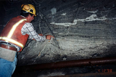
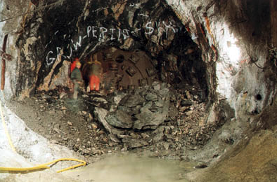
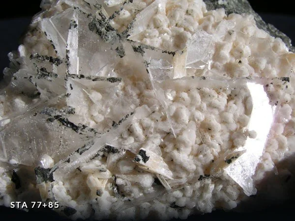
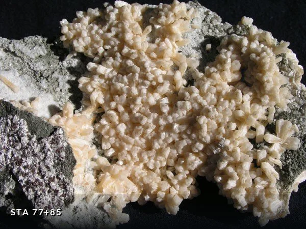
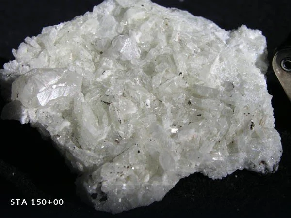
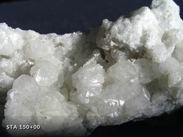
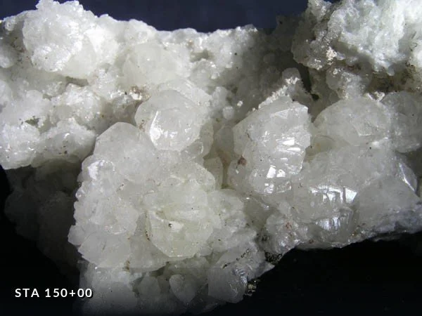
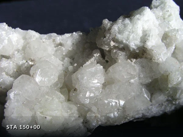
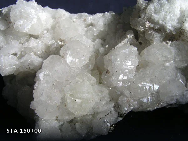
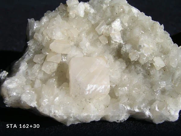
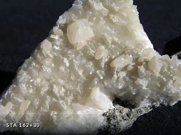
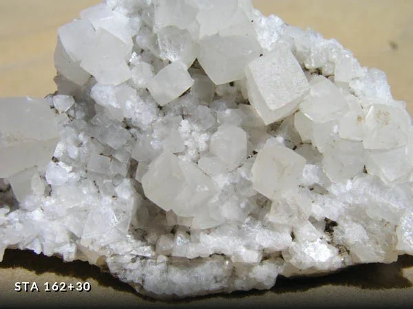
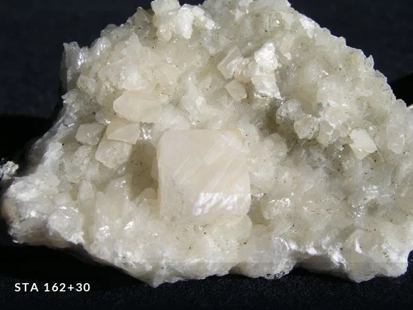
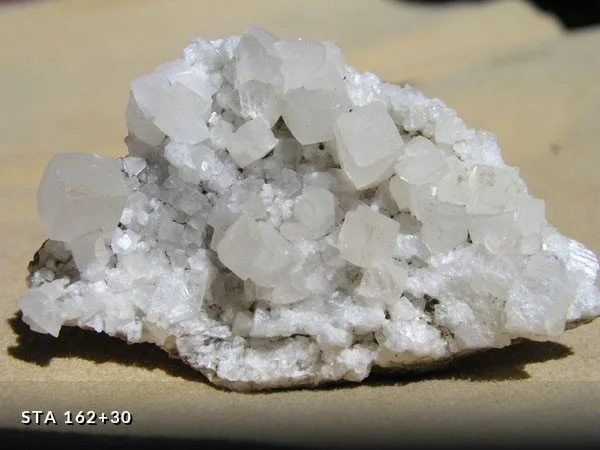
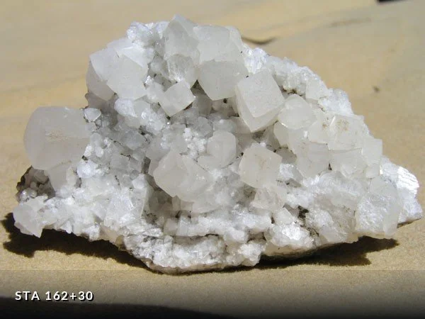
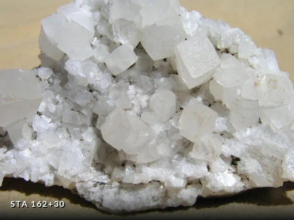
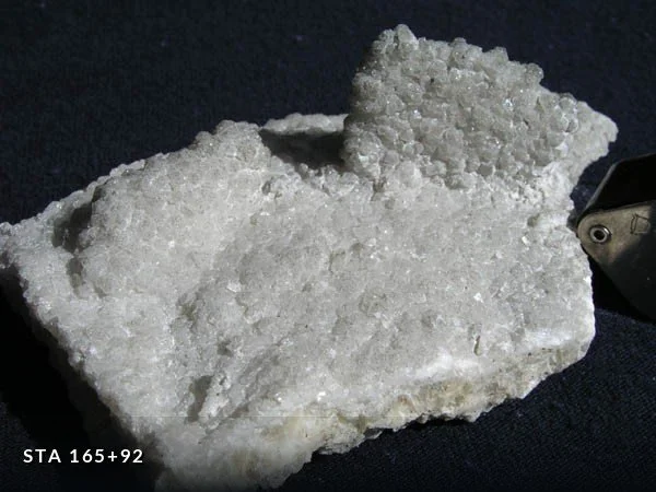
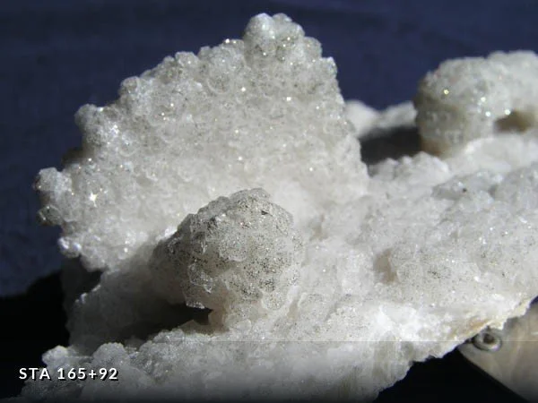
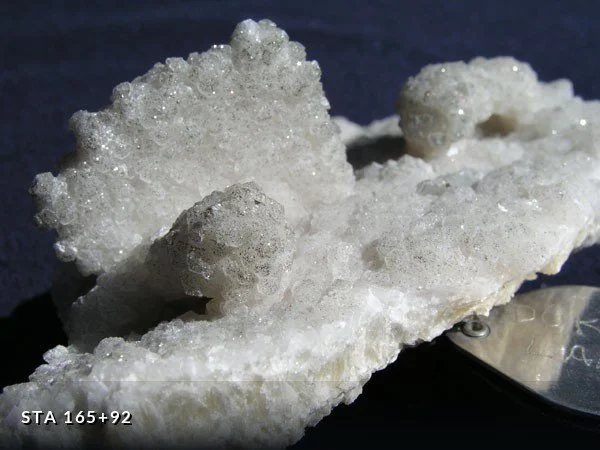
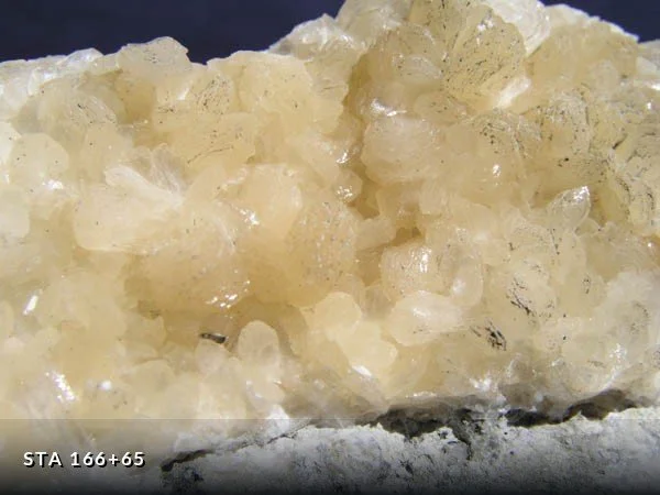
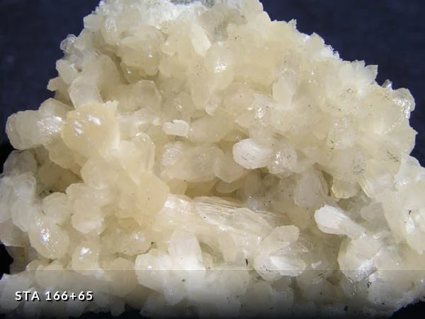
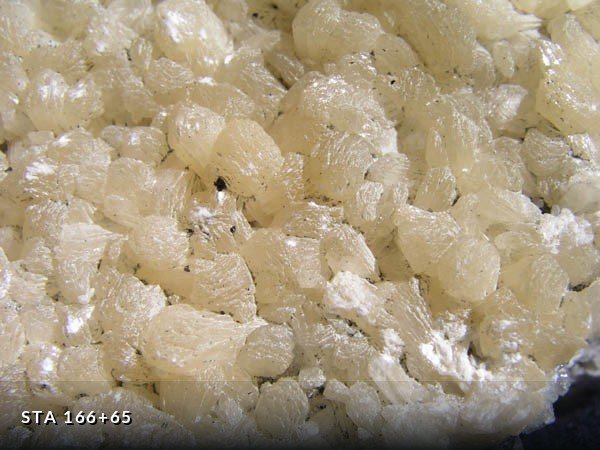
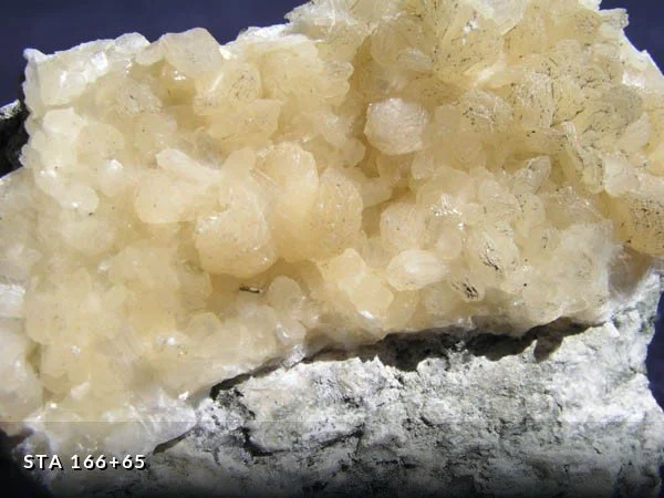
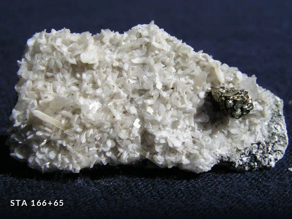
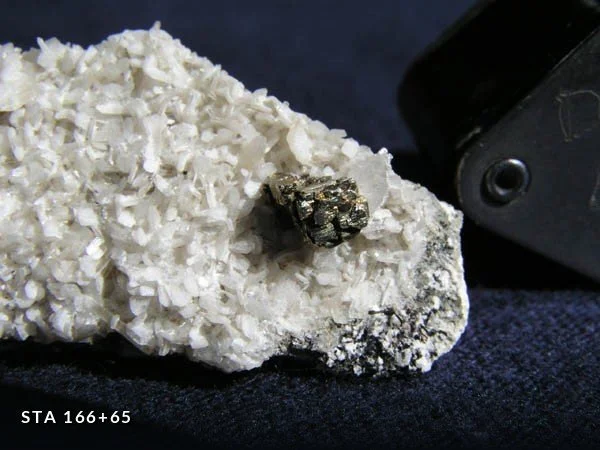
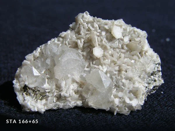
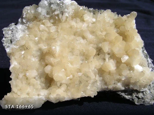
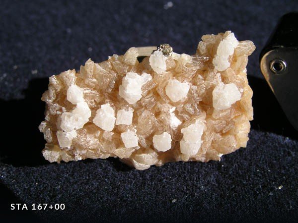
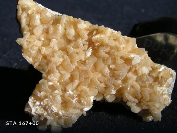
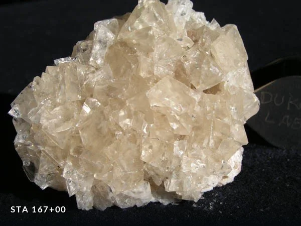
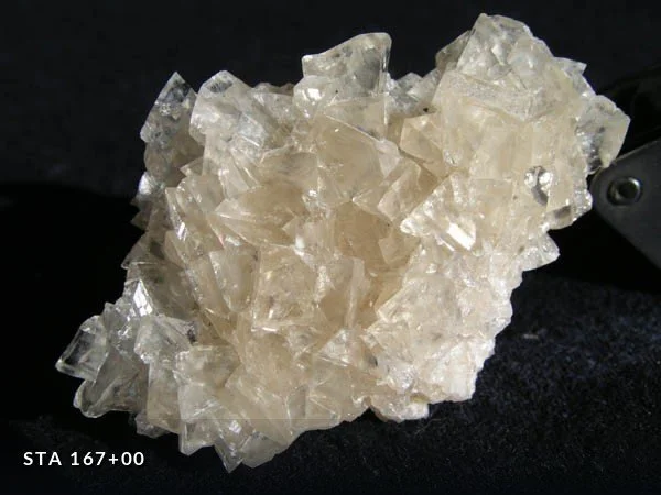
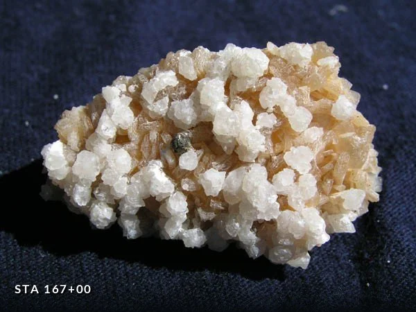
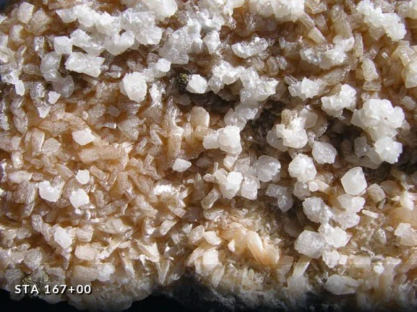
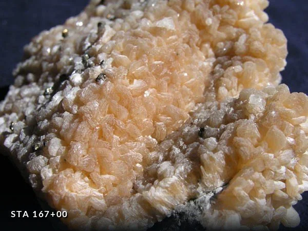
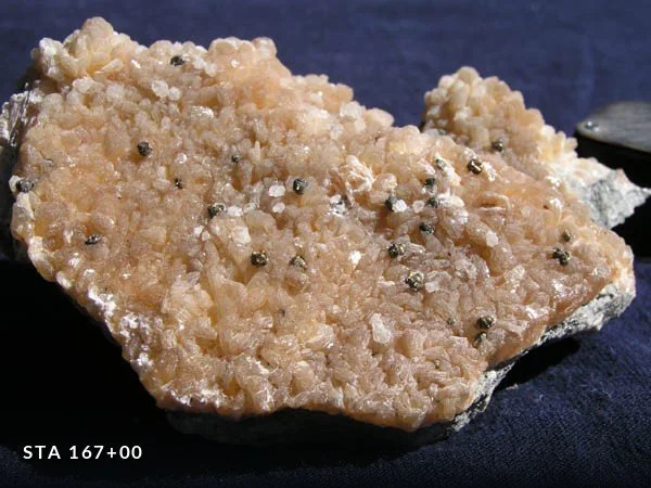
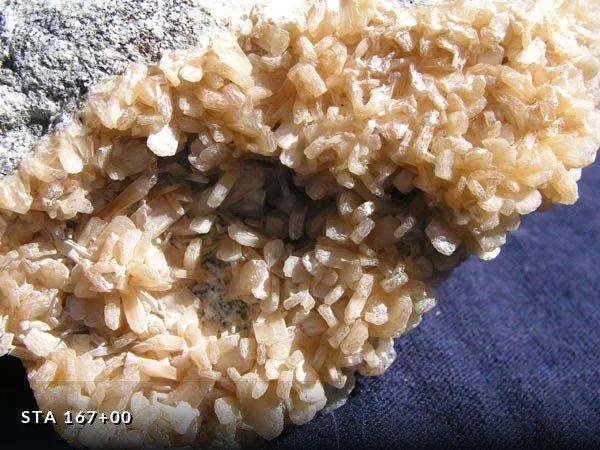
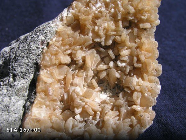
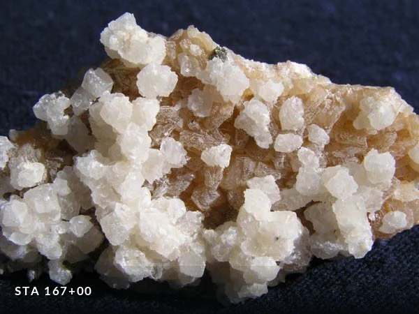
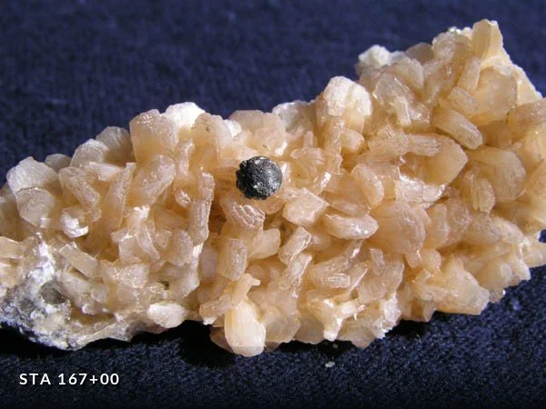
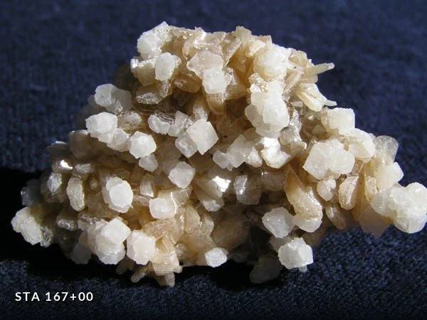
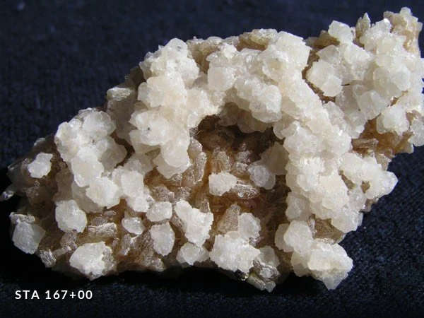
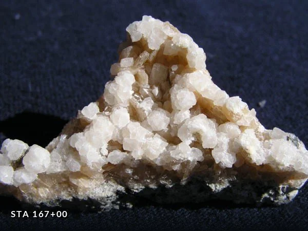
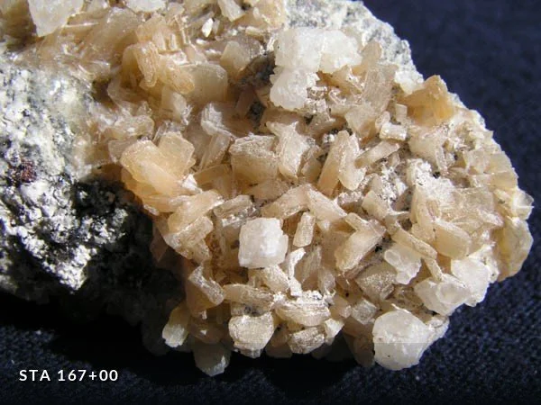
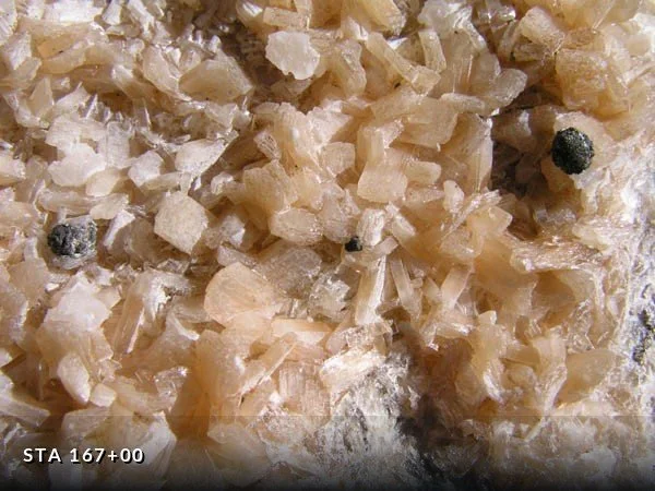
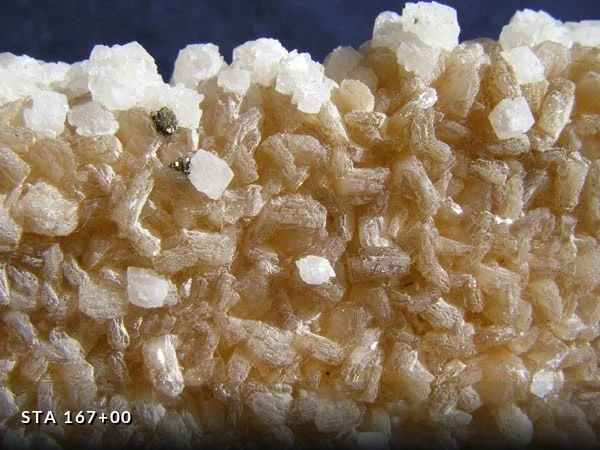
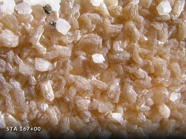
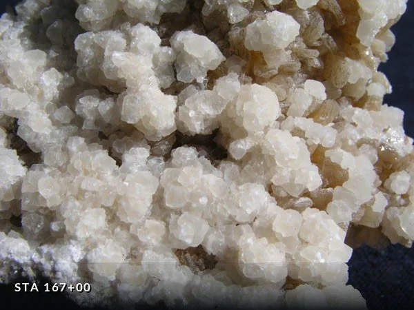
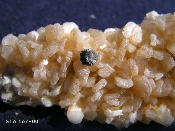
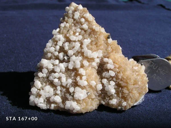
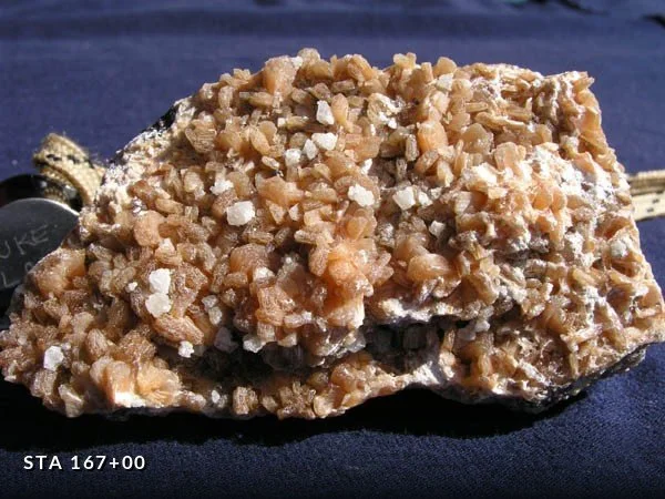
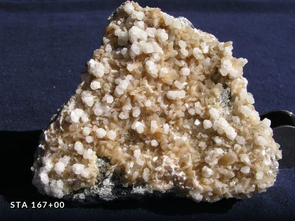
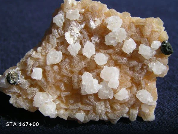
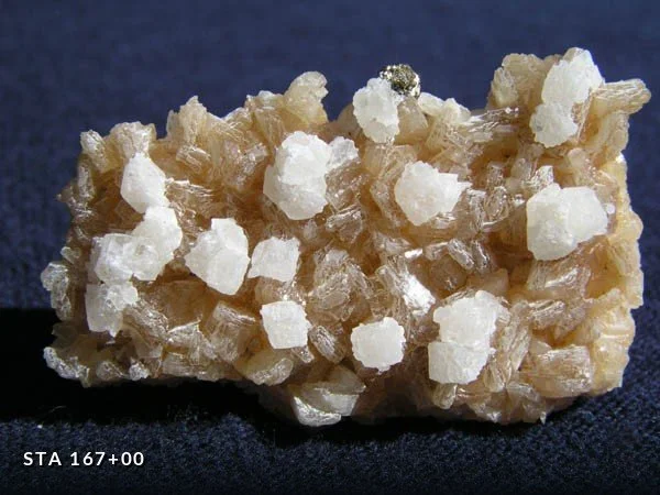
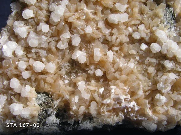
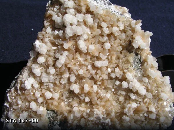
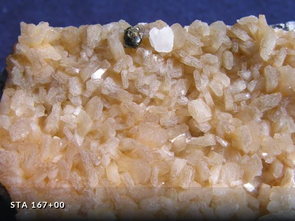
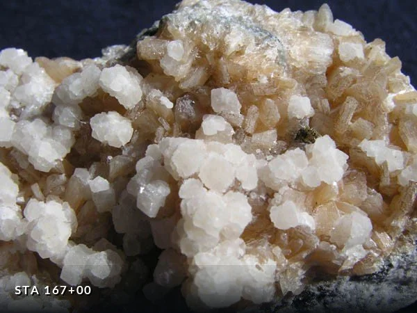
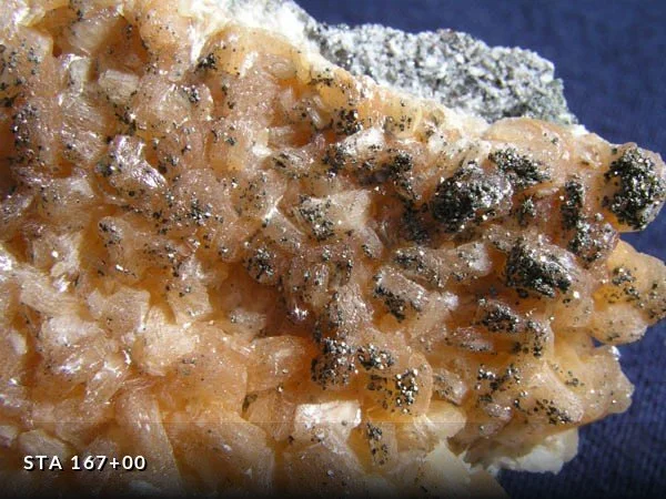
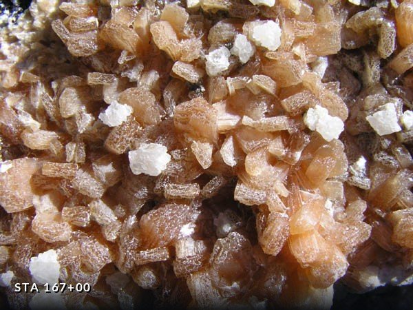
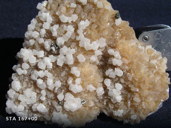
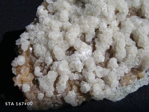
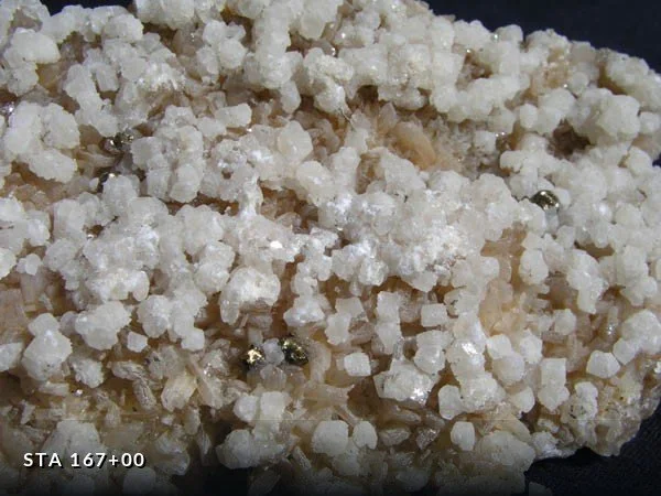
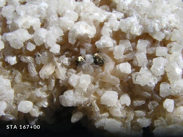
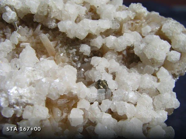
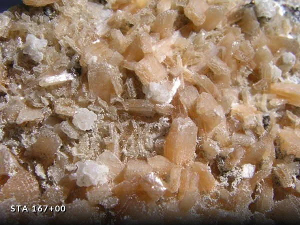
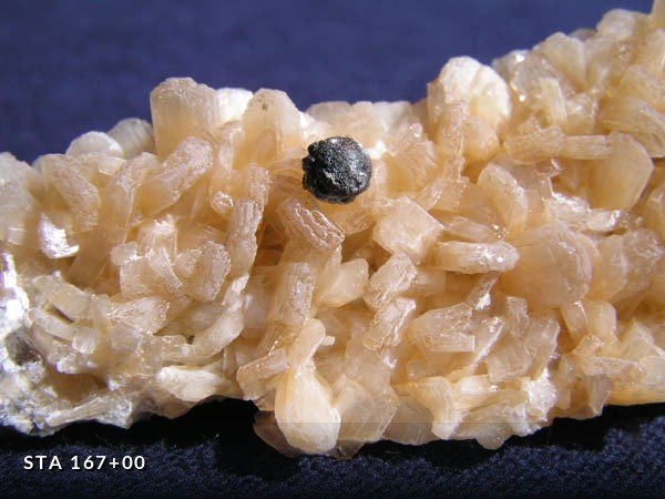
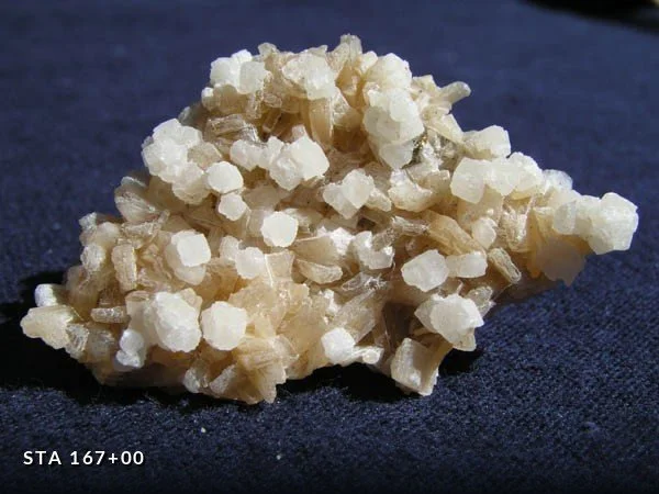
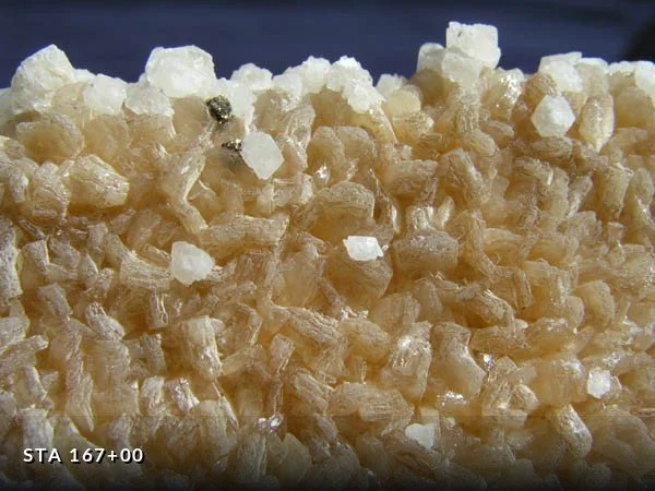
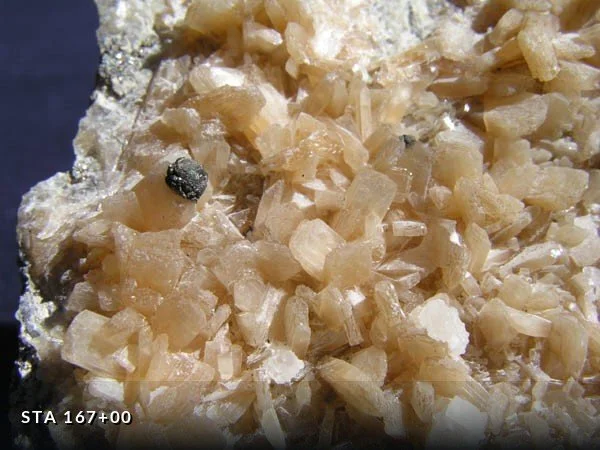
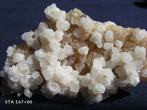
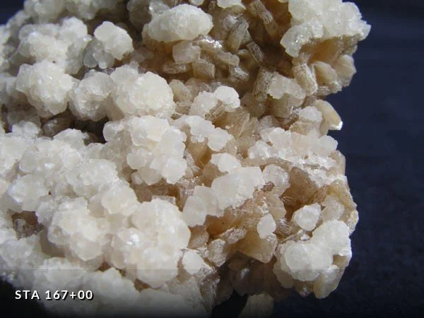
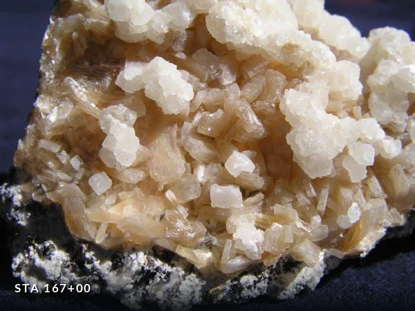
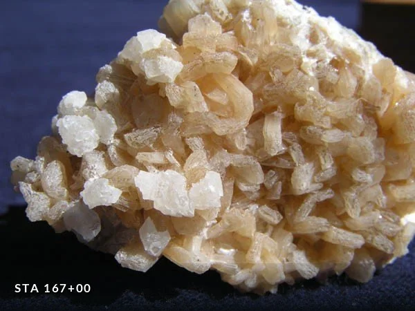
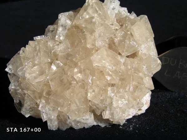
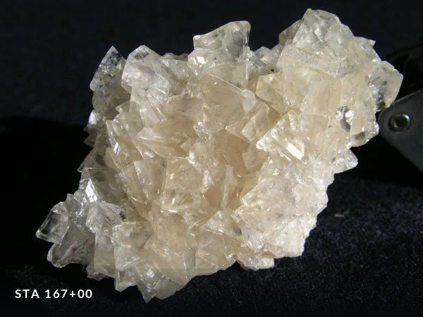
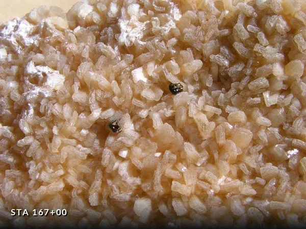
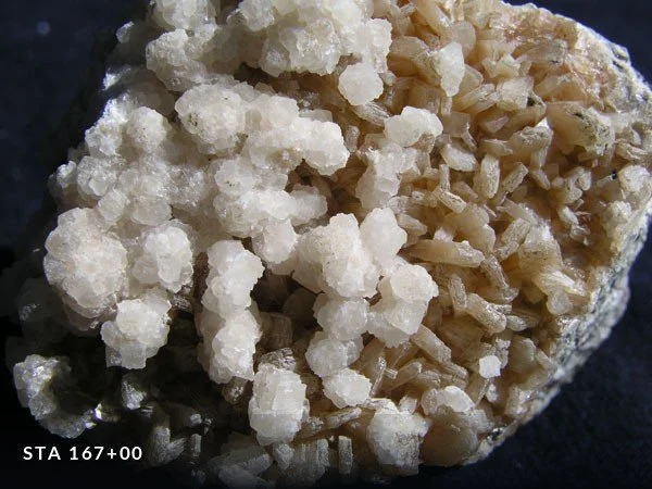
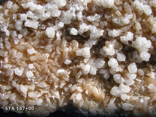
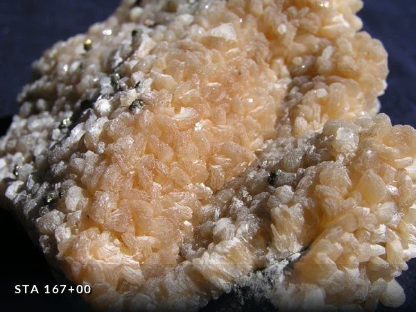
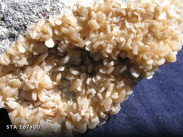
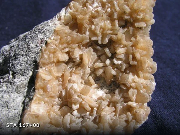
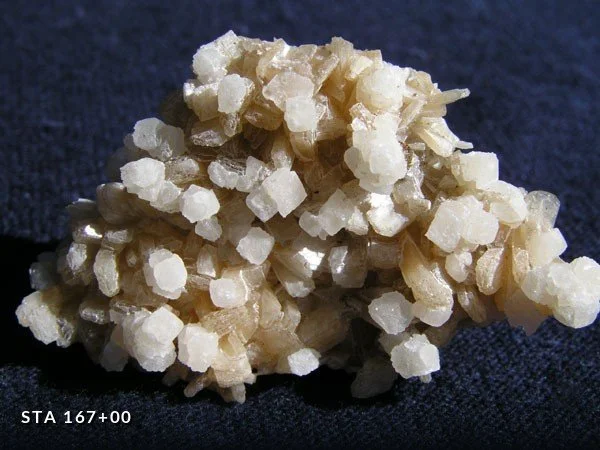
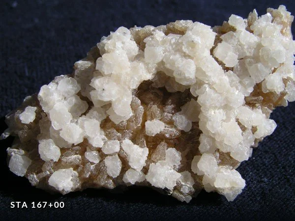
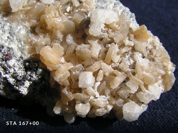
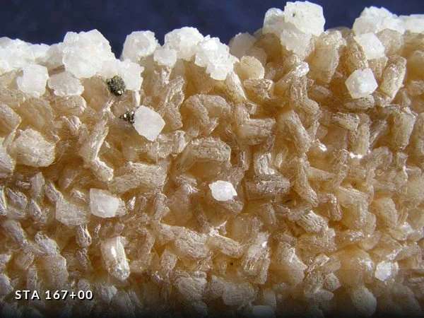
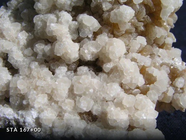
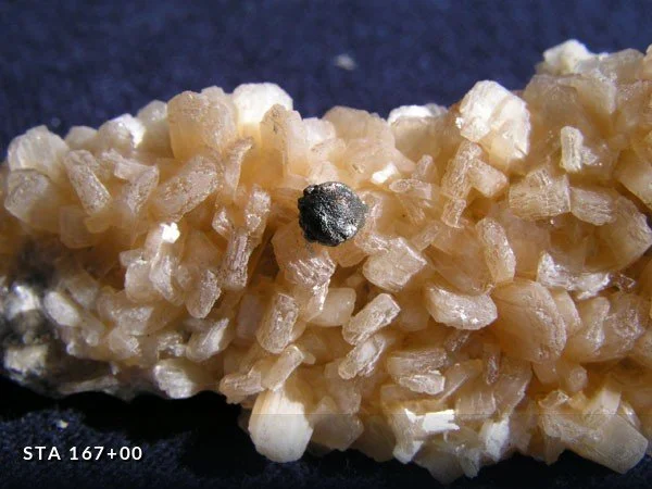
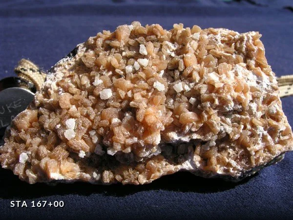
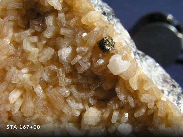
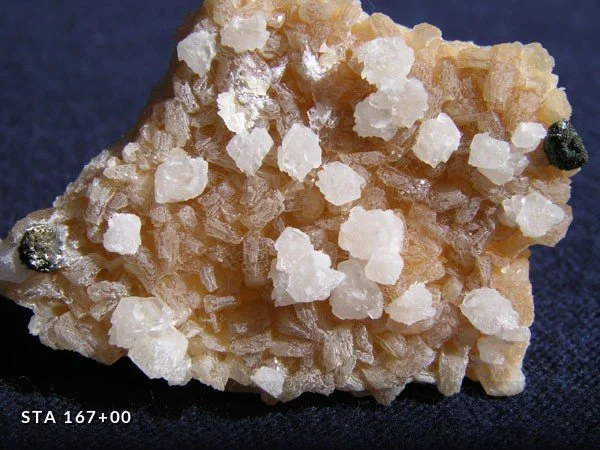
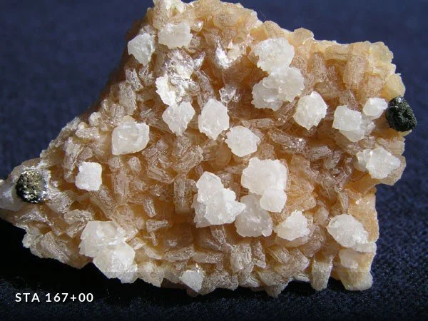
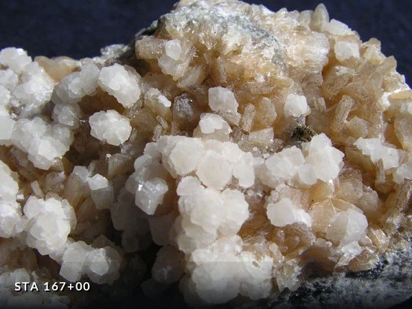
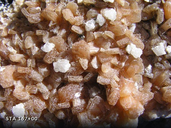
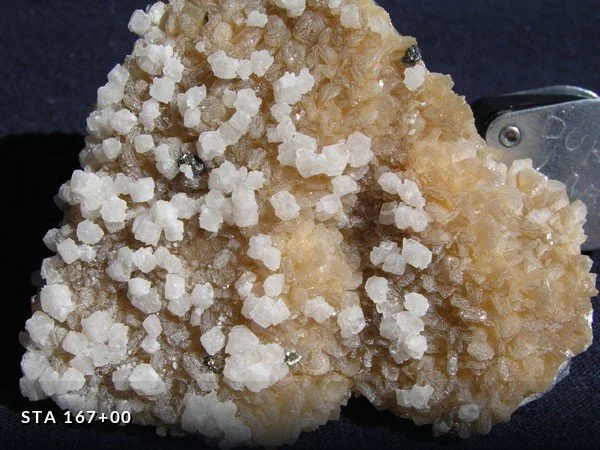
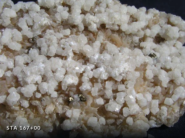
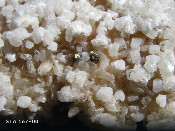
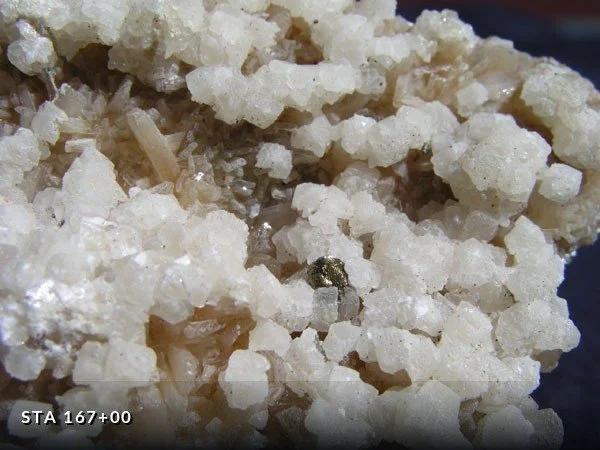
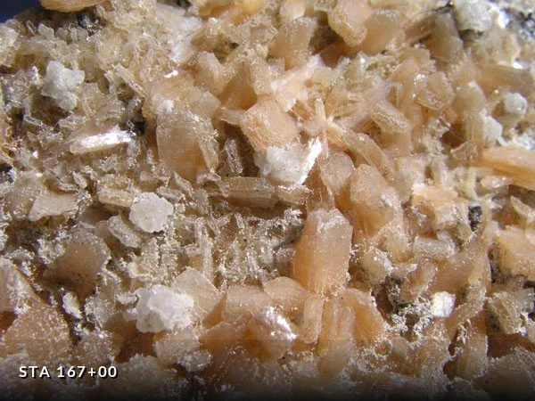
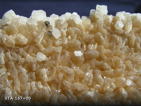
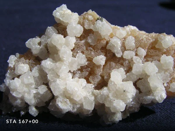
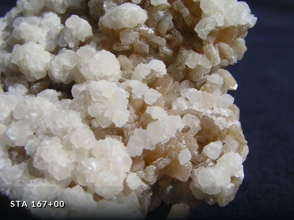
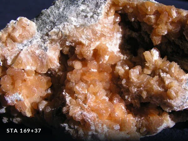
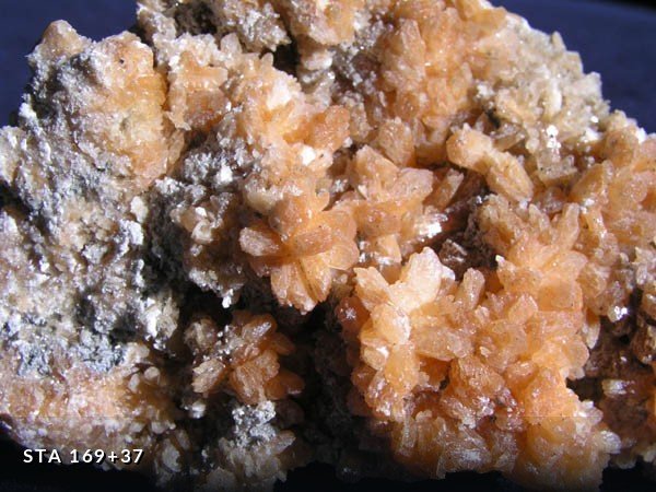
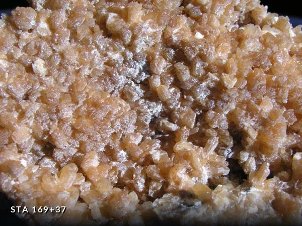
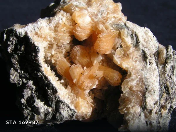
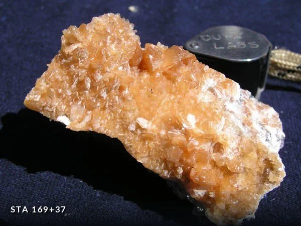
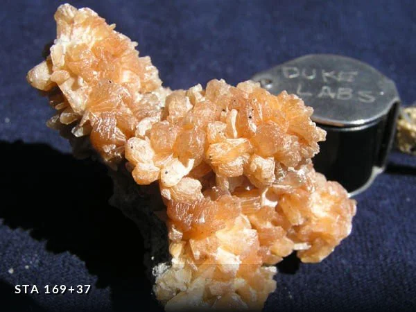
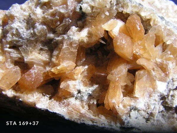
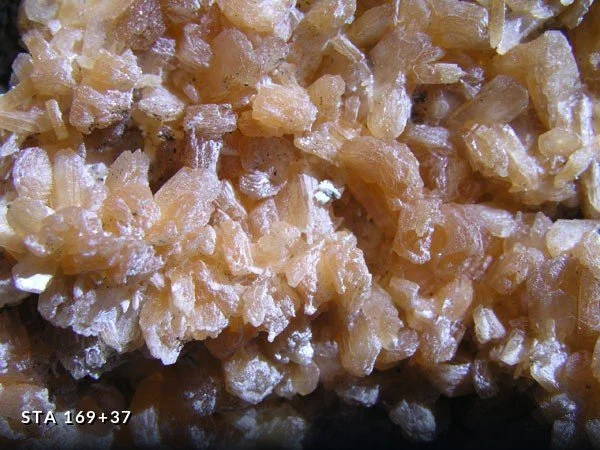
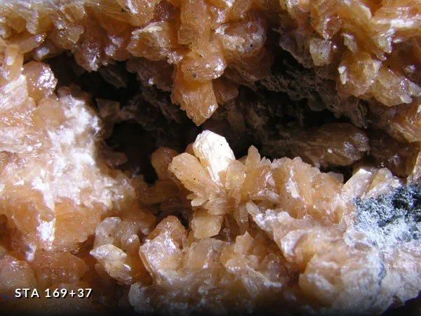
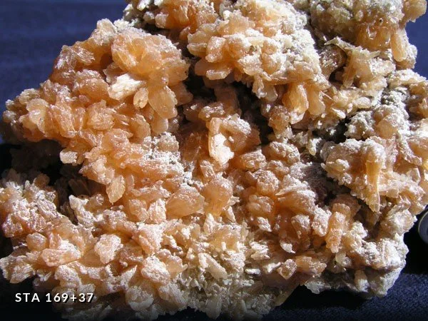
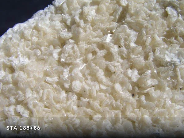
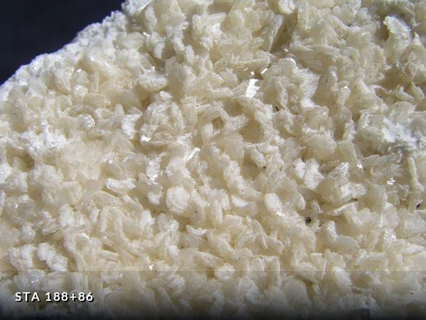
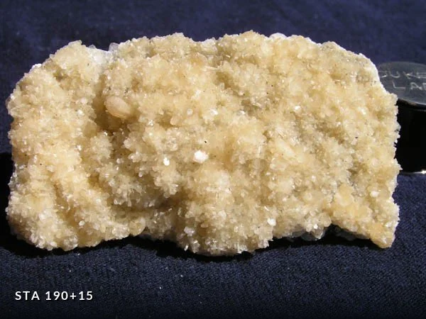
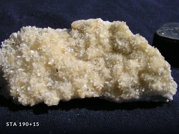
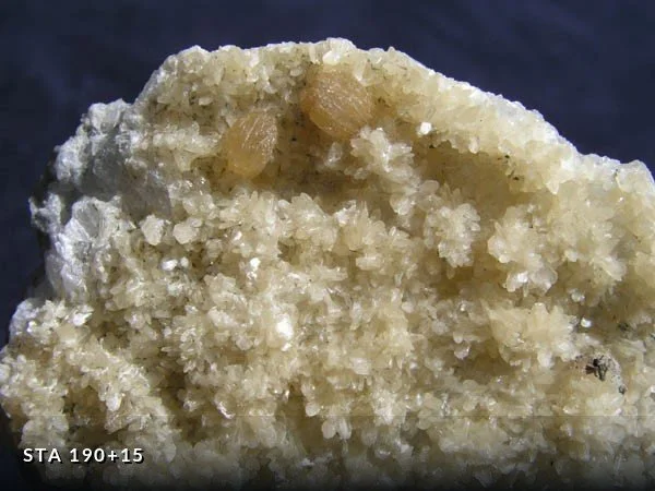
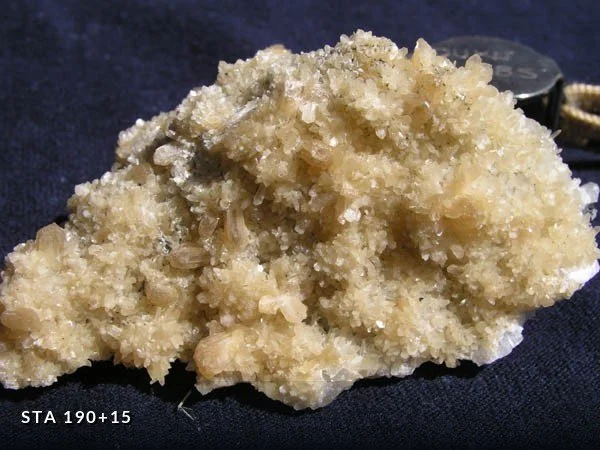
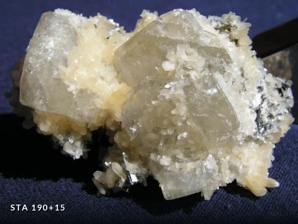
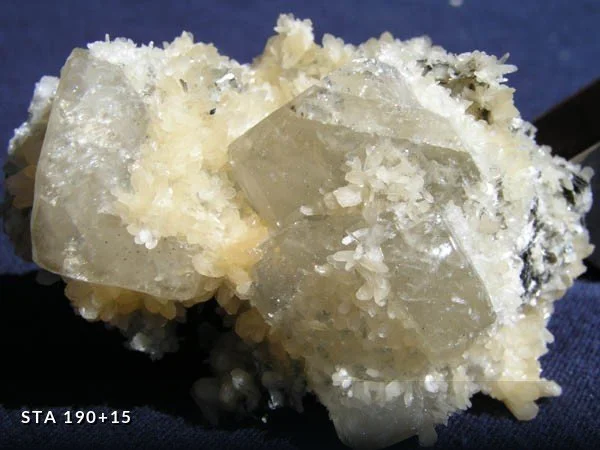
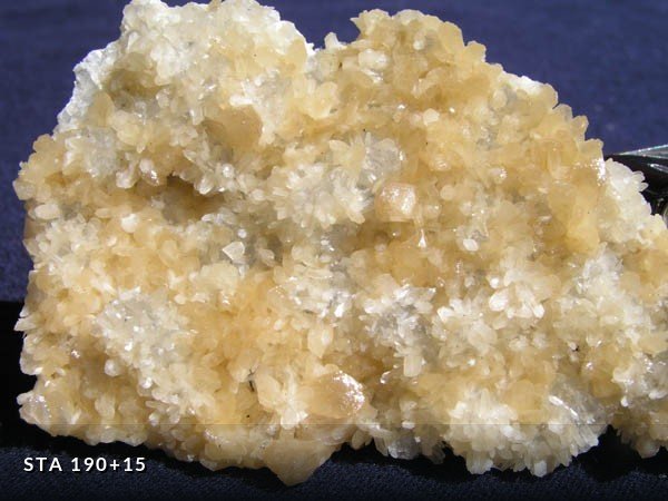
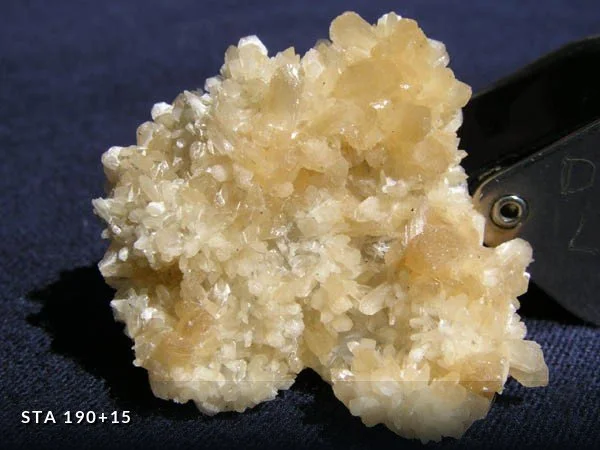
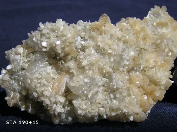
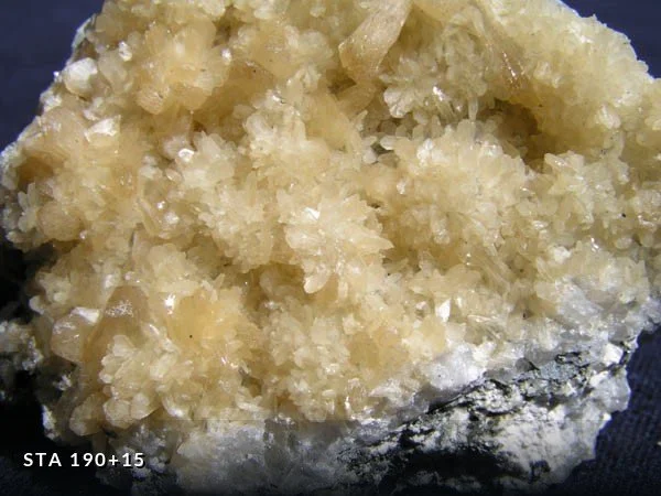
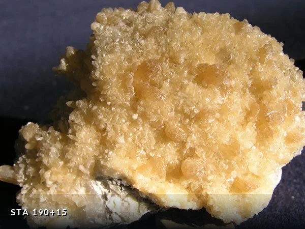
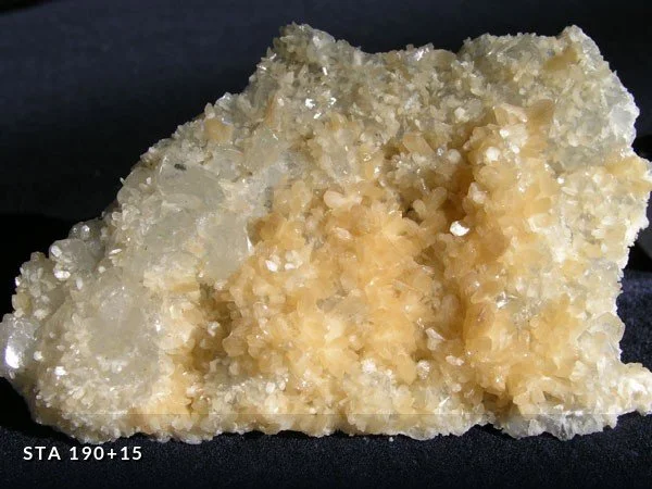
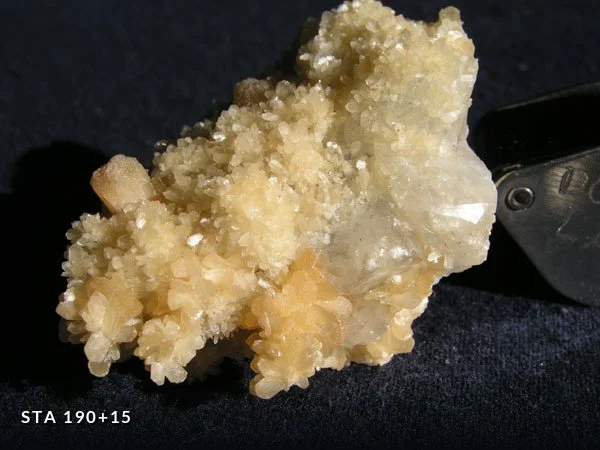
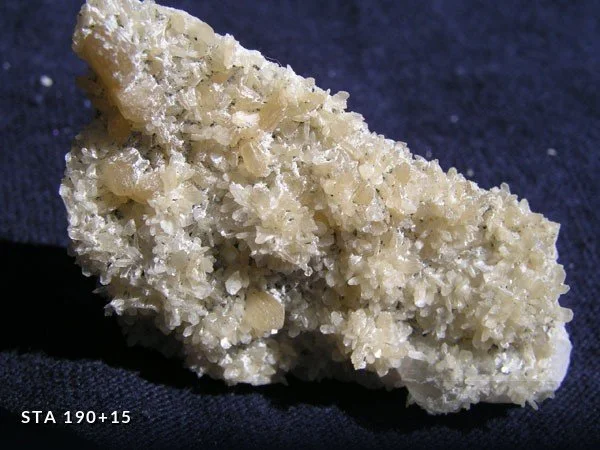
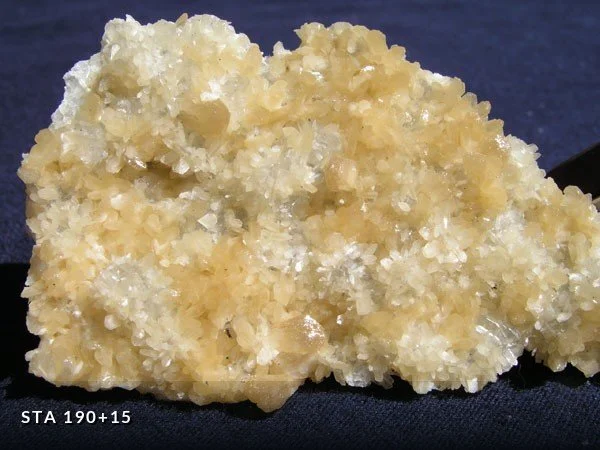
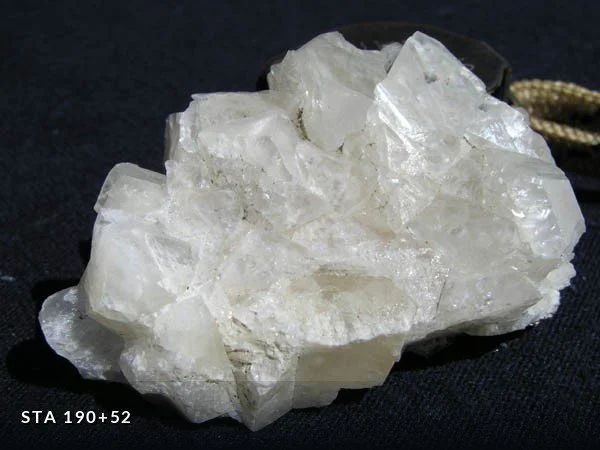
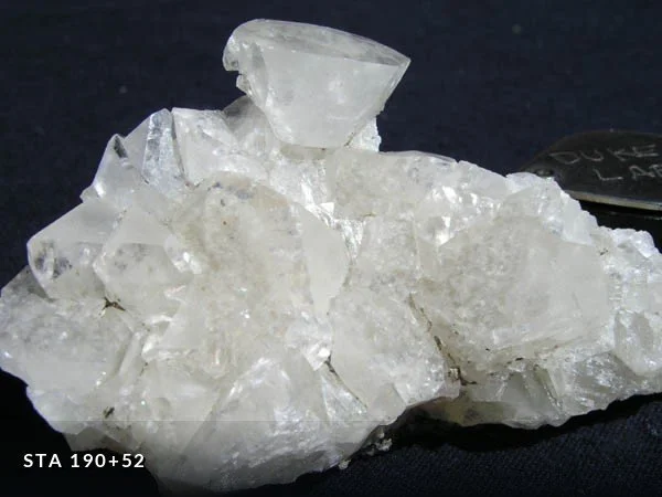
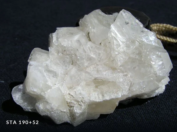
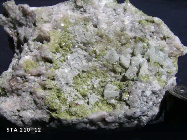
Every specimen below is labelled with the tunnel station where it was collected. Station numbers give distance in feet from Shaft 19B in Maspeth, where the bore began — so Station 167+00 lies 16,700 feet along the tunnel, and the final hole-through at Shaft 16B is Station 254+92, a little over five miles in. Where a wall is noted, LW and RW refer to the left and right walls facing increasing station numbers.
Full descriptions of each collecting station appear at the foot of this page.
Macrominerals
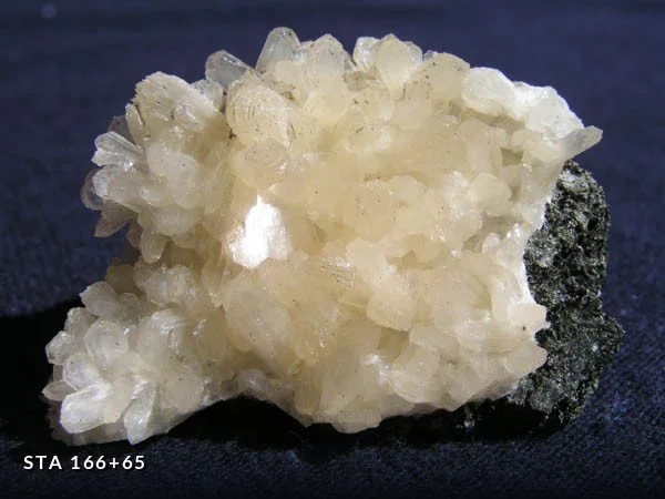
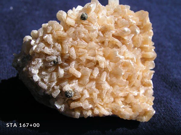
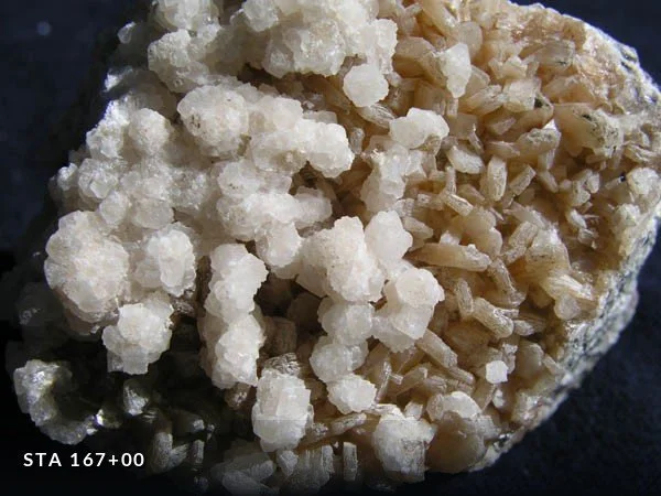
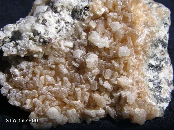
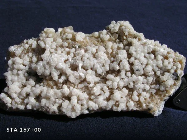
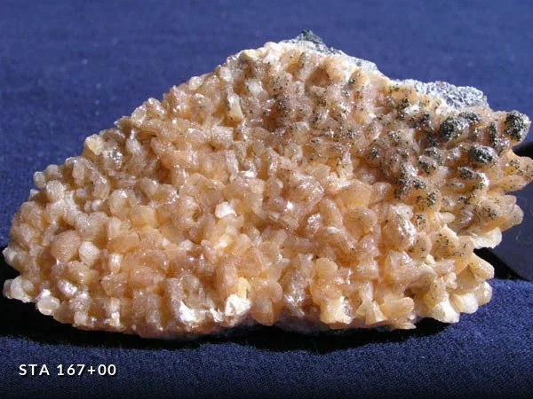
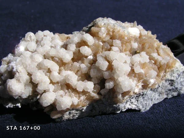
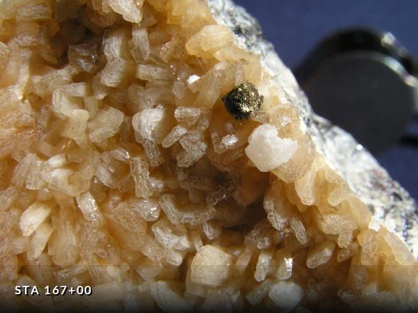
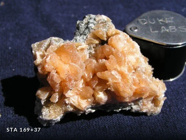
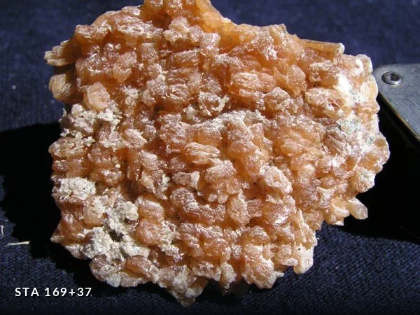
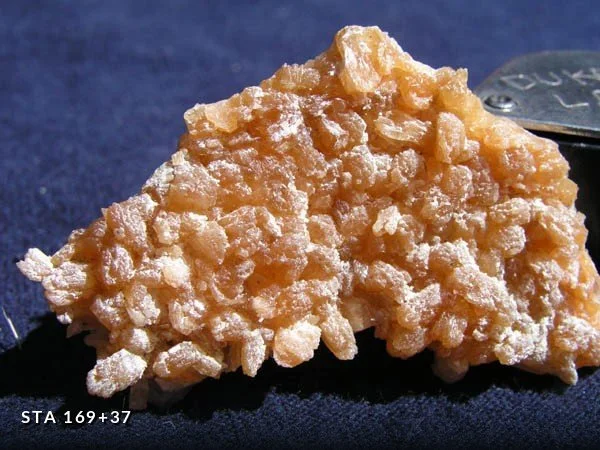
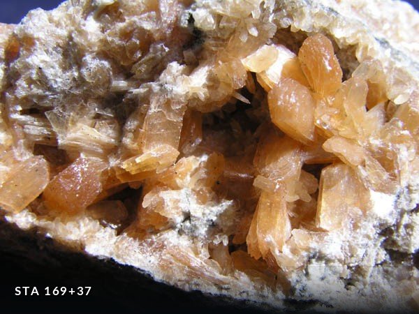
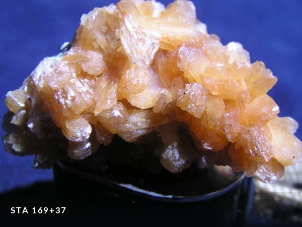
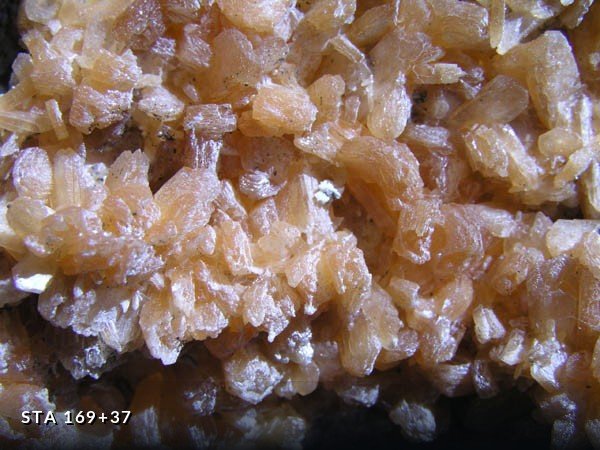
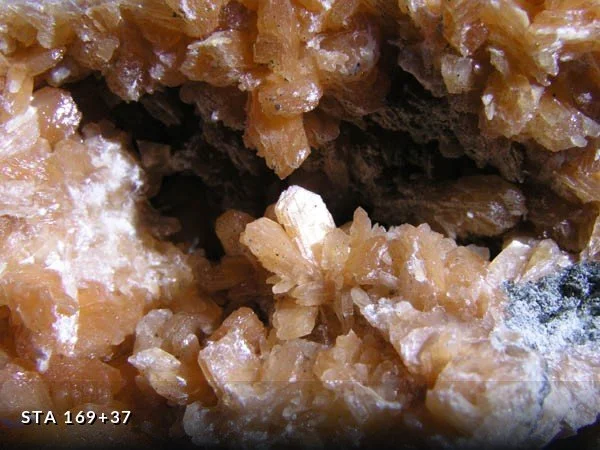
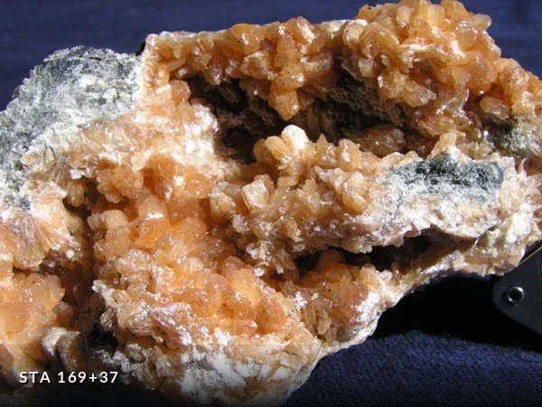
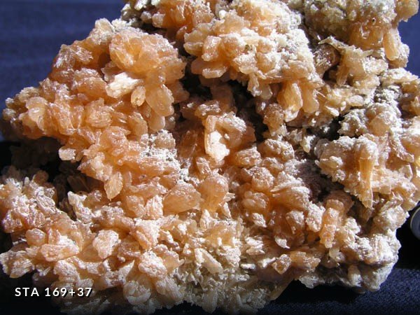
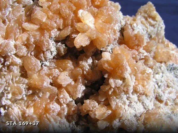
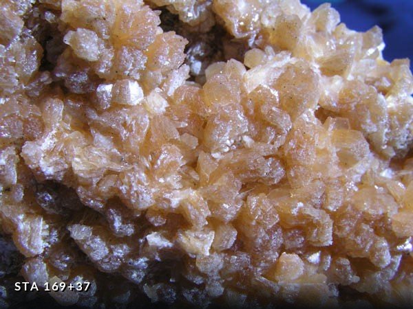
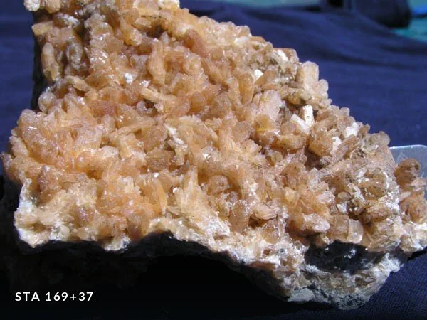
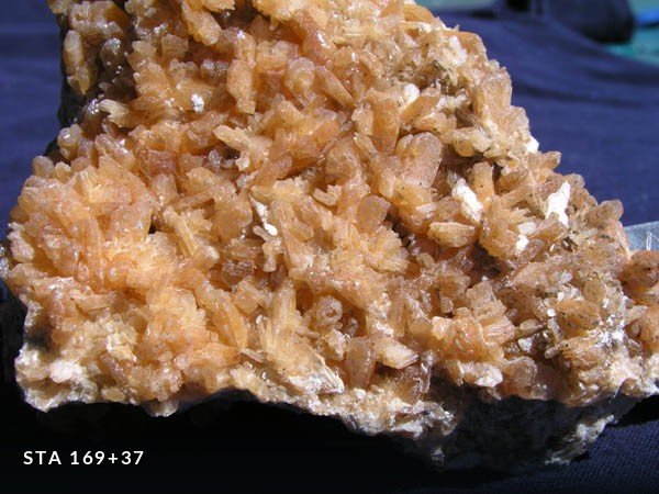
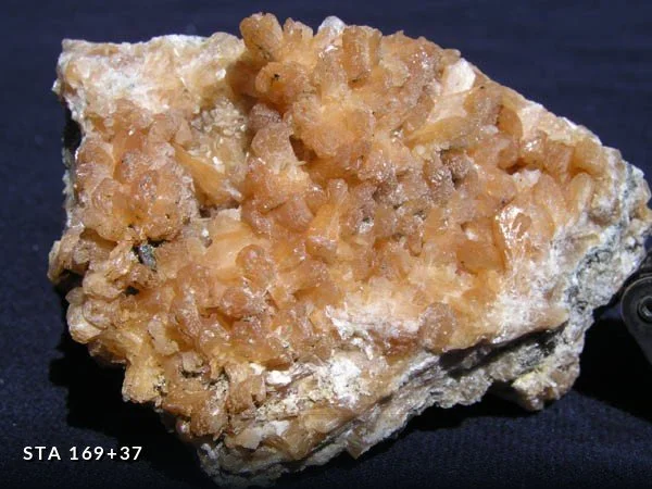
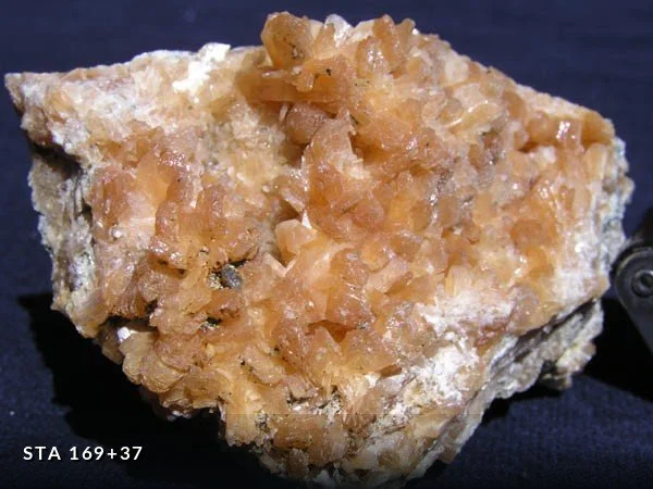
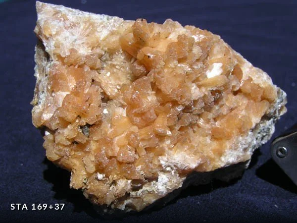
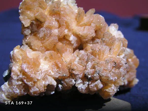
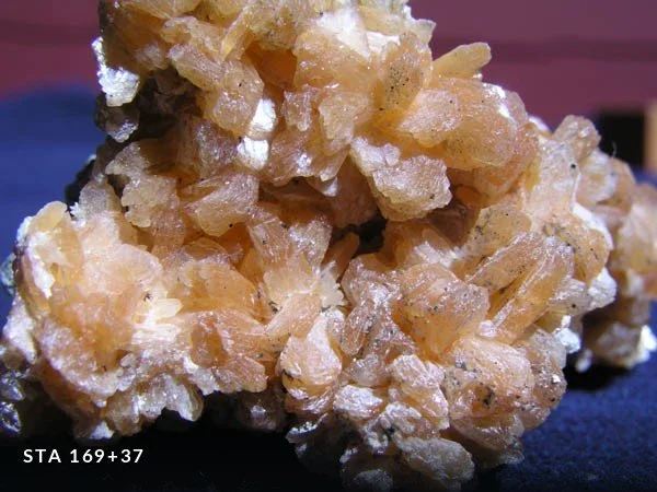
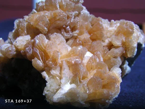
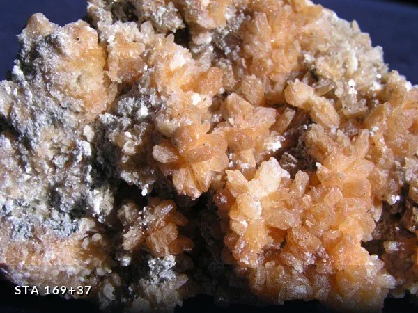
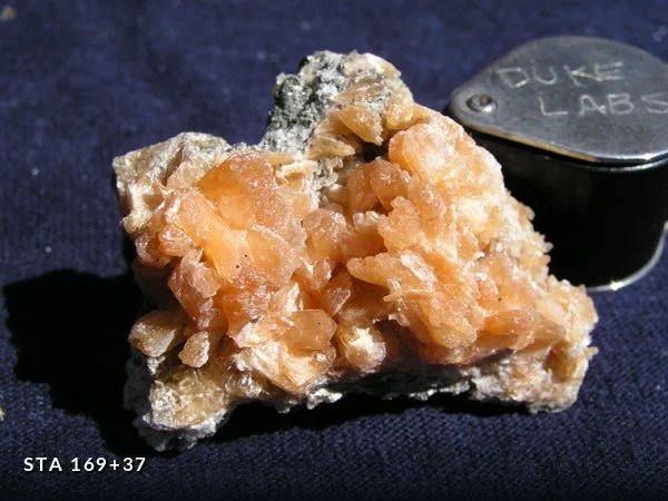
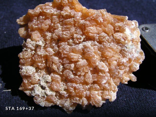
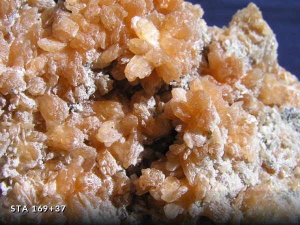
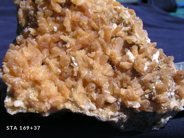
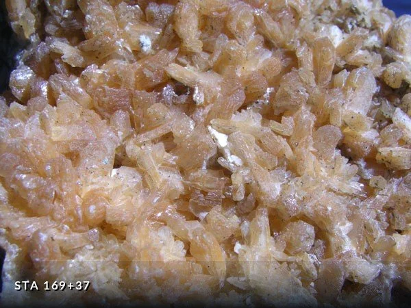
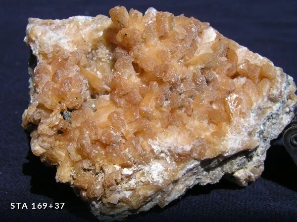
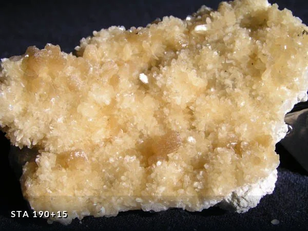
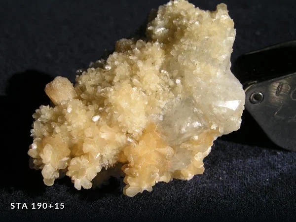
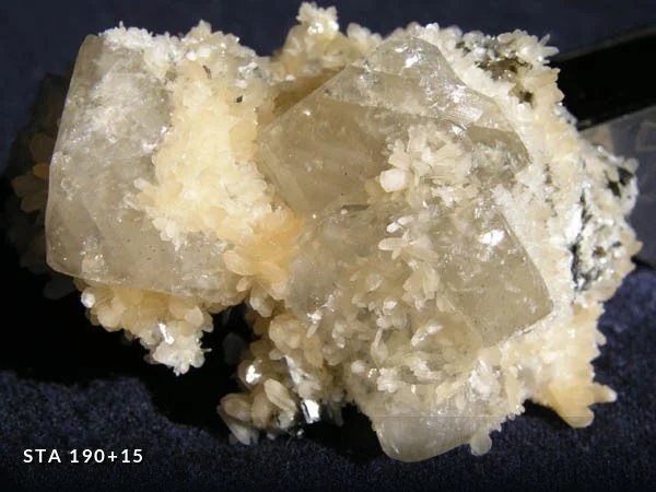
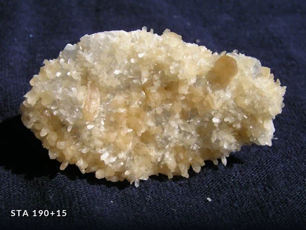
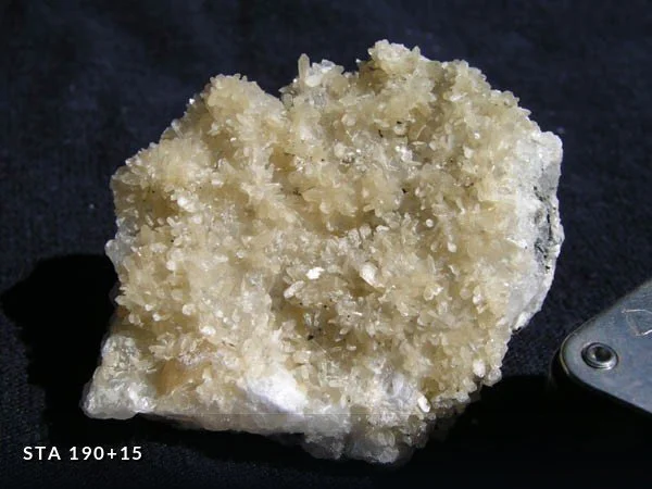
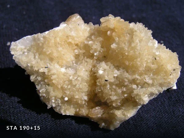
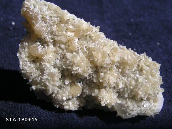
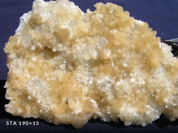
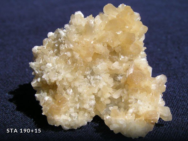
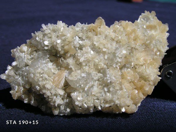
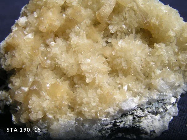
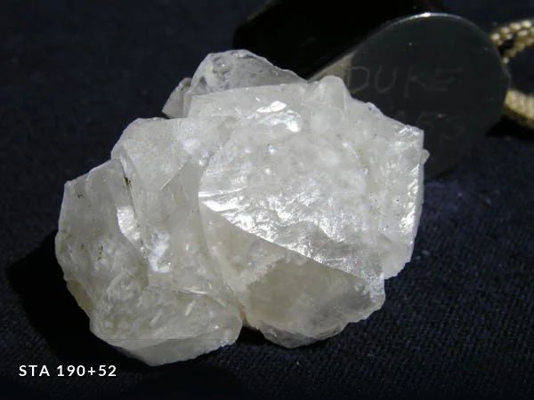
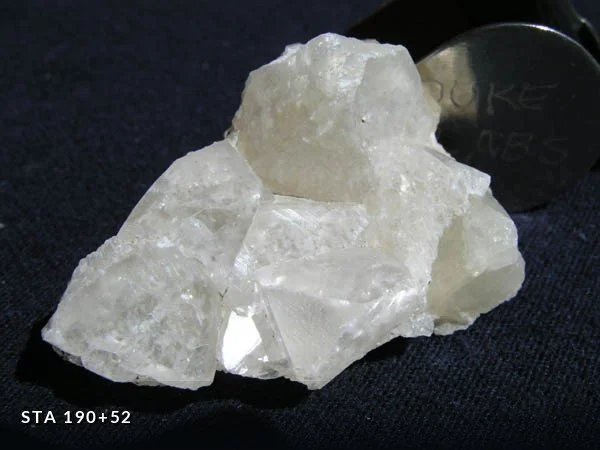
Specimens photographed with a digital camera. Most were recovered from fault zones and pegmatite pockets exposed as the tunnel boring machine advanced — material that was visible for a matter of days before the bore was lined and sealed.
Microminerals
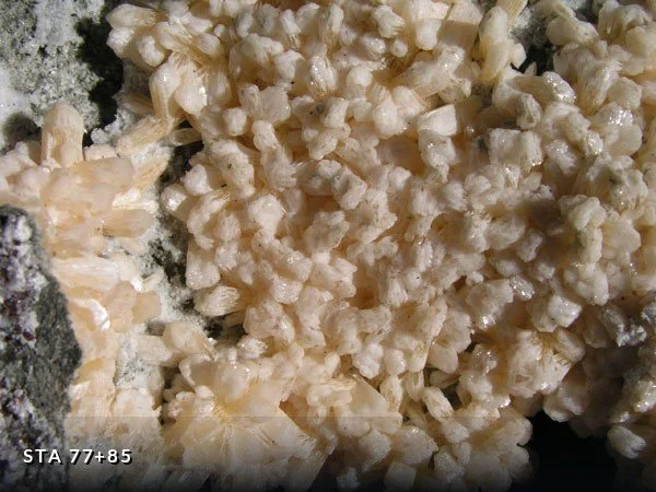
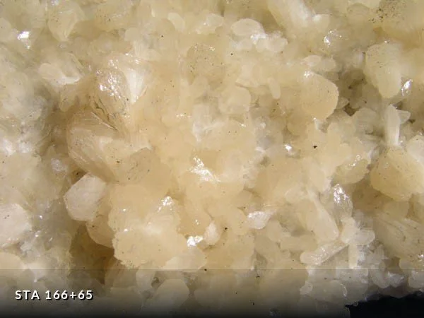
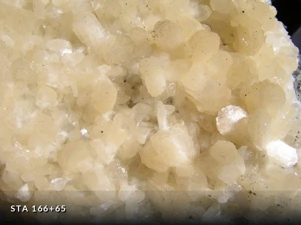
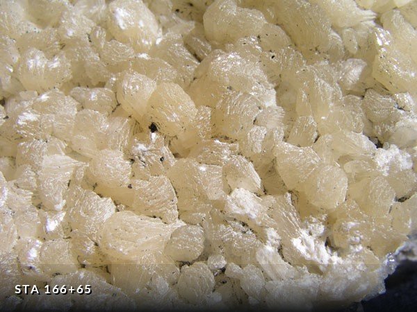
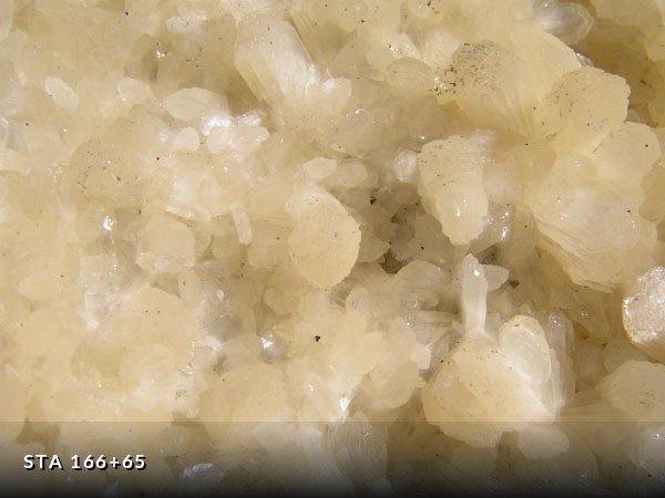
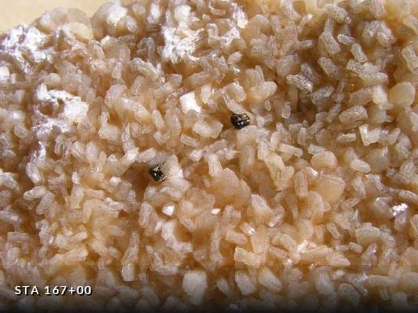
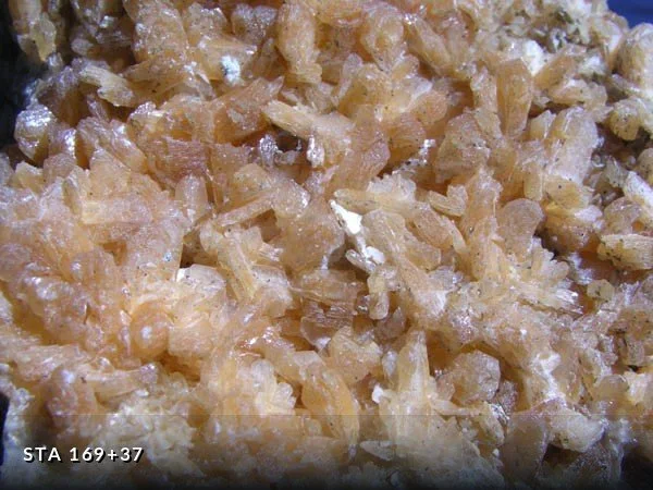
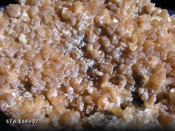
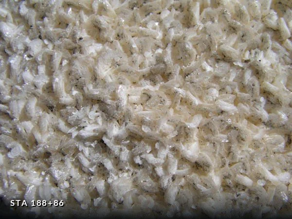
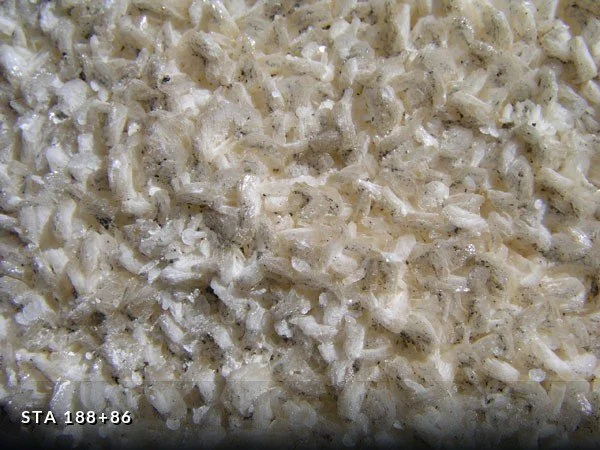
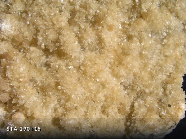
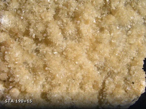
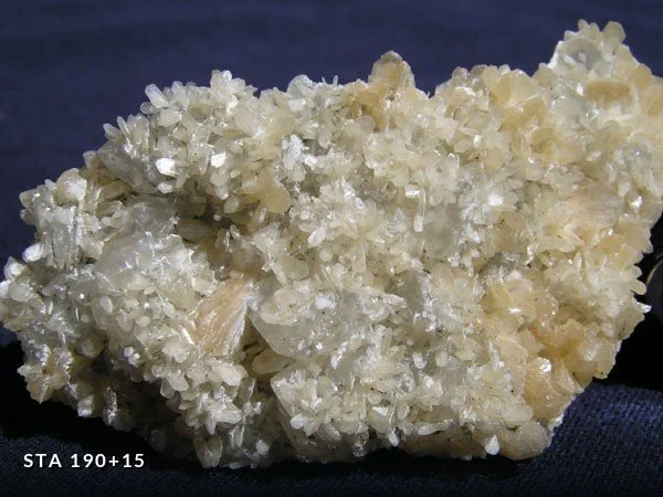
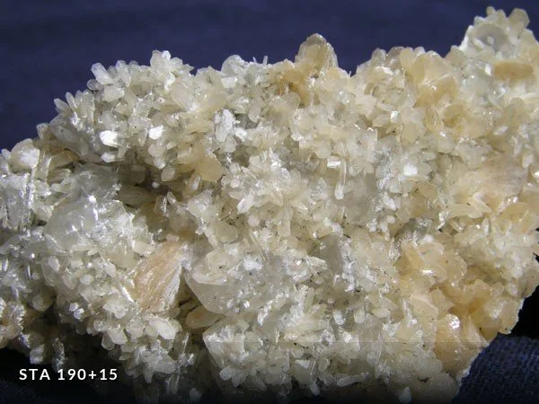
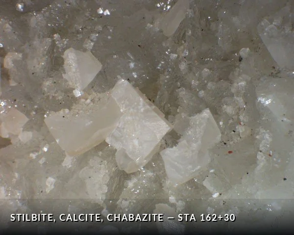
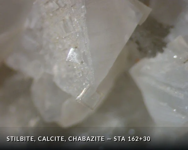
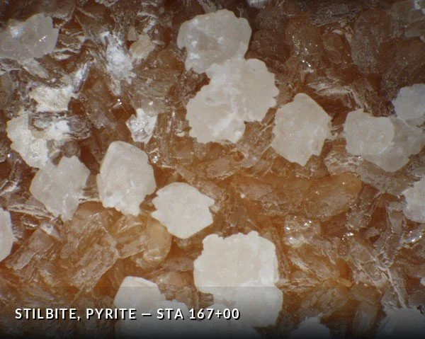
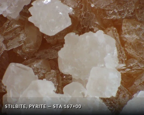
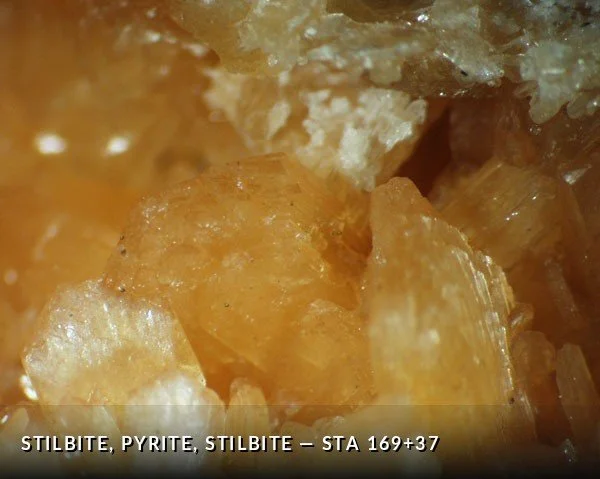
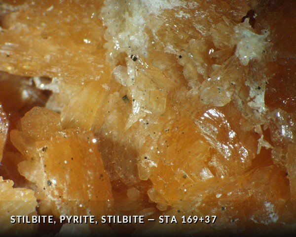
The same localities at higher magnification, photographed through a stereoscopic microscope. Crystal habit at this scale is what allowed many of the zeolites to be identified — stilbite by its sheaf-like blades, chabazite by its near-cubic rhombohedra, analcime by the clarity of its facets.

Mineral Localities by Station
Minerals were collected from individual and reactivated faults and from pegmatites during the mapping of the Queens Tunnel between 1996 and 1999. Identifications were made under a stereoscopic microscope using standard physical property tests — lustre, colour, hardness, streak, cleavage and crystal form.
The entries below record what was found at each collecting station: the mineral assemblage, the orientation and dip of the fault or fracture that hosted it, the geometry of the veins and cavities, and the dates of collection. Match a station number from any specimen above to its entry here.
A few stations are described without accompanying photographs. They are retained as field records.
Station 030+750 images
Deep lime green drusy and microcrystalline epidote in veins up to 1 cm thick on a substrate of altered mafic gneiss.
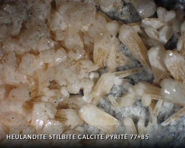
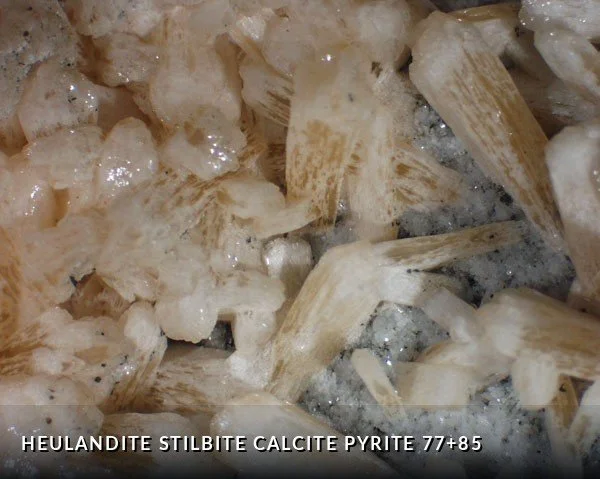
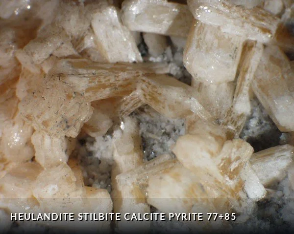
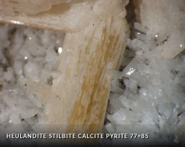
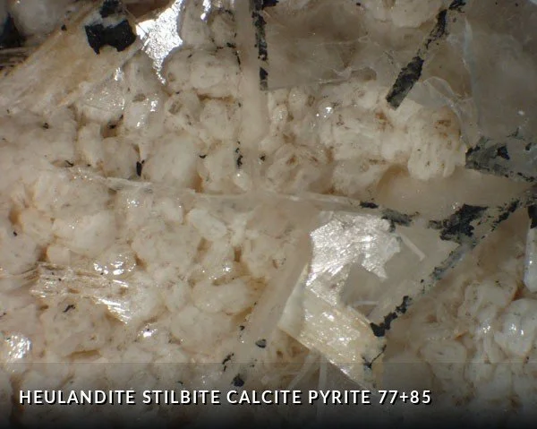
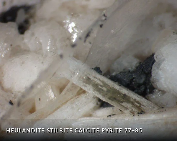
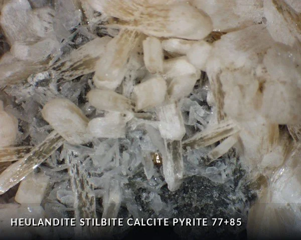
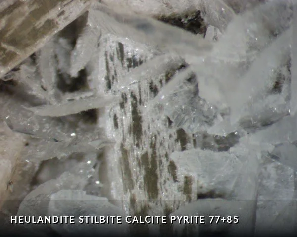
Station 077+8516 images
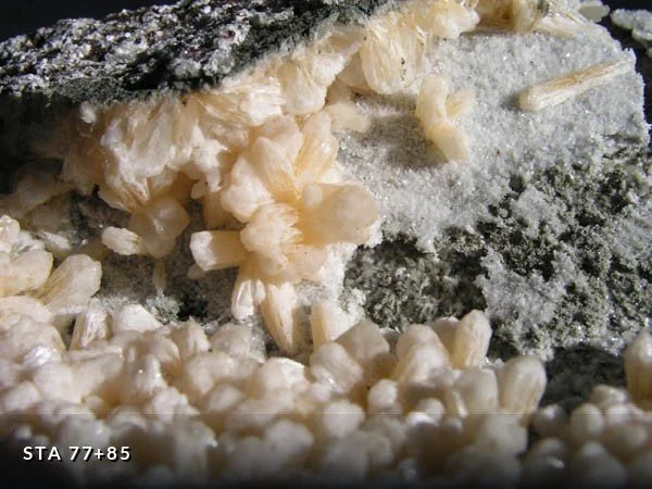
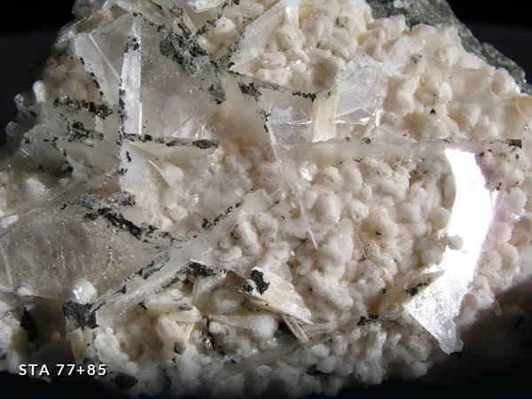
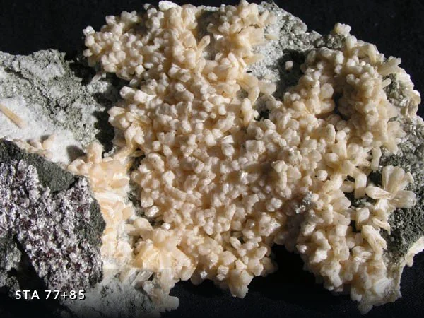
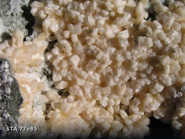
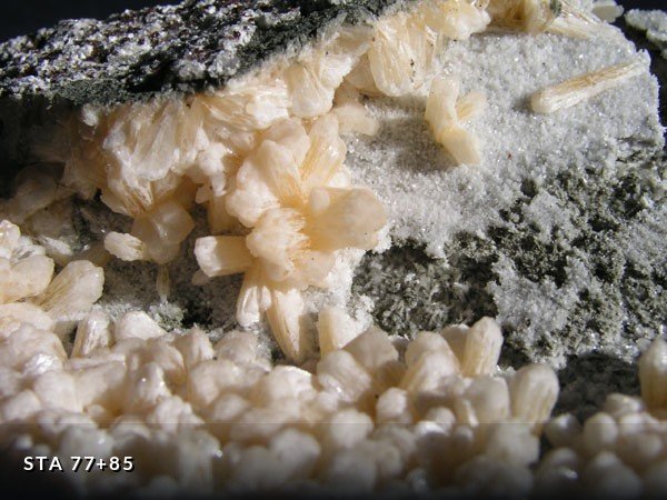
Upon a substrate of heulandite, cream-colored stilbite in hemispherical masses 2 cm wide and as felted crystalline masses of single sheaf-like crystals. The stilbite is overgrown by calcite and by pyrite. Mineralization occurs in a NS-trending reverse fault cutting interlayered garnet-diorite orthogneiss and garnet amphibolite. Collected 9/9/99 and 2/8/00.
Station 093+35RW0 images
Blue plagioclase euhedral 1-2 cm crystals (sweats) in gabbroic gneiss cut by pegmatite and normal fault. Collected 10/12/99.
Station 101+000 images
Massive pyrite and quartz in a vein along NNW-trending fault.
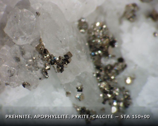
Station 150+009 images
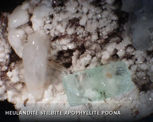
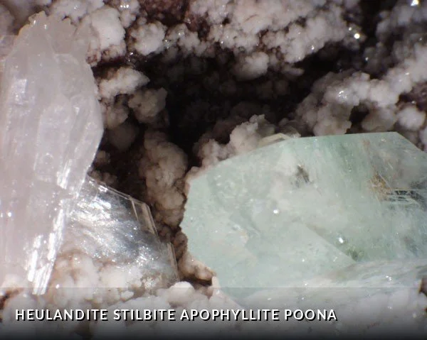
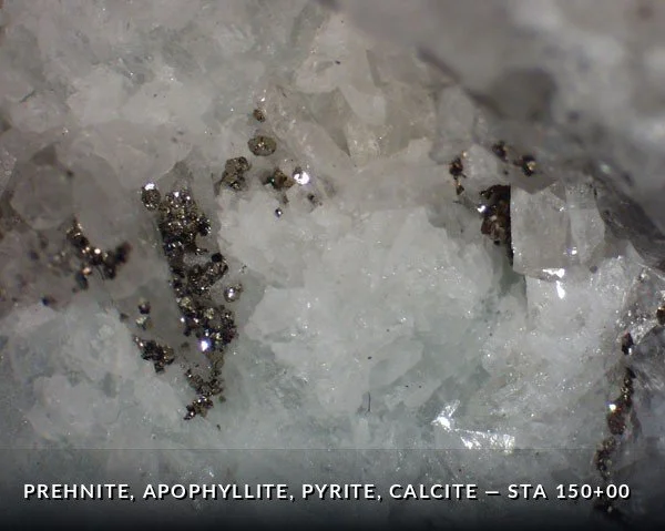
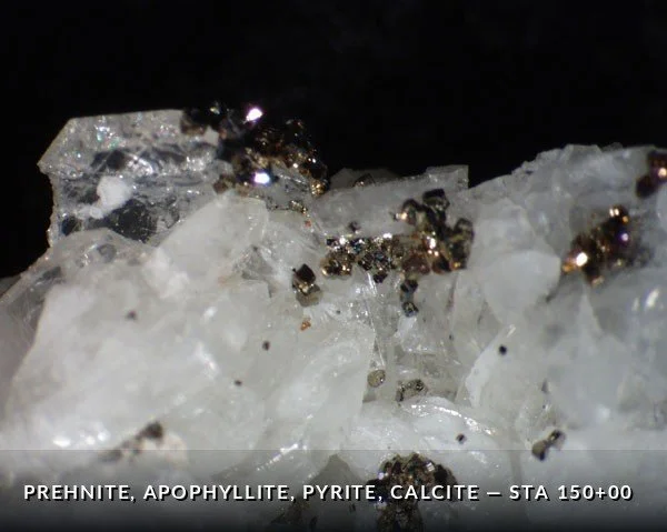
Fallen block from left rib containing greenish radiating masses of prehnite overgrown with apophyllite, pyrite, and calcite crystals. Pointed out by Joe Brown and collected 6/15/98.
Station 151+002 images
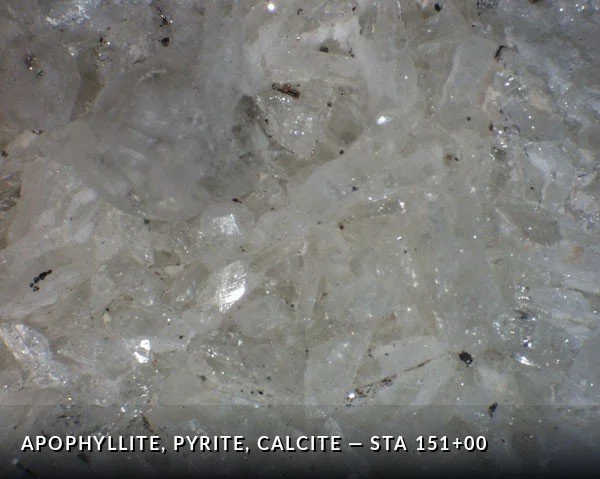
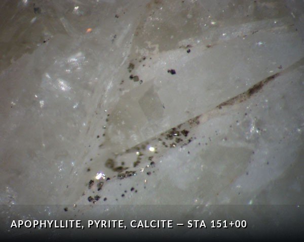
Apophyllite with pyrite and calcite. Collected 6/10/98.
Station 151+002 images
Pyrite crystals in dacite host. Collected 6/10/98.
Station 162+30RW12 images
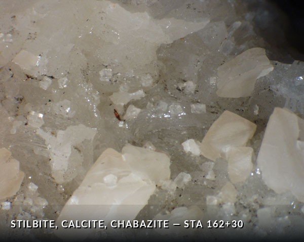
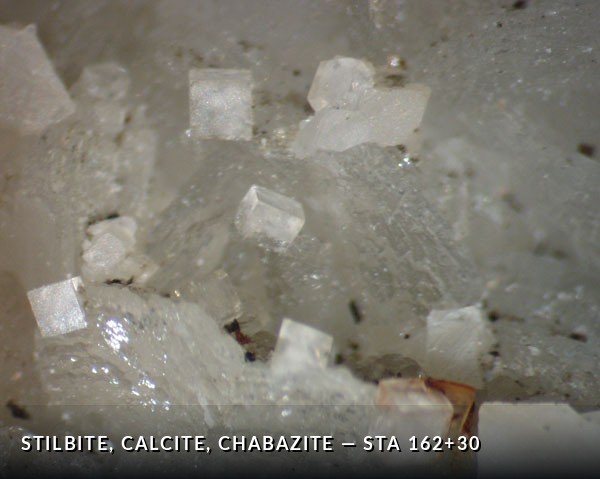
Stilbite forming a base with calcite crystals and cubic, clear chabazite microcrystals in a NNE-trending reverse fault zone. Collected 1/11/99 and 2/8/99.
Station 165+92RW5 images
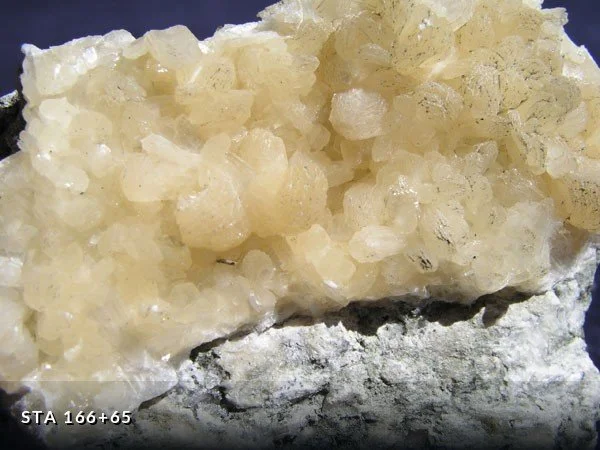
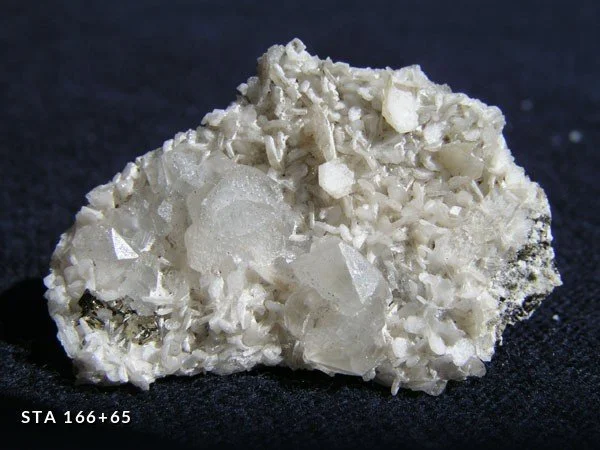
Yellowish stilbite as a base to calcite crystals and drusy pyrite. The stilbite crystals, found in N20°E, 71°SE fault, grew as fibers perpendicular to the fracture. Collected 1/11/99.
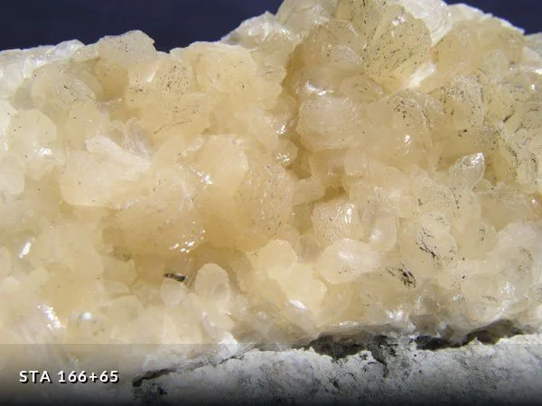
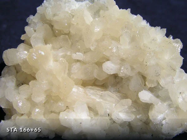
Station 166+65RW23 images
Yellowish stilbite, calcite, and drusy pyrite crystals in N22°E, 77°NW-trending fault zone. Collected 1/11/99.
Station 167+00RW&LW116 images
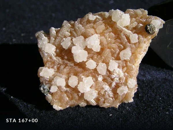
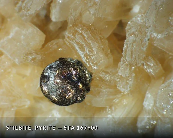
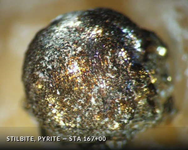
Major 35’-wide NNE faulted pegmatite zone with box-work open cavities and greenish clay gouge. Megascopically, stilbite blades are overgrown by 2-3 mm spherical masses of pyrite. The multifaceted spherical masses are superceded by calcite crystallization, all on a fractured pegmatite or amphibole-gneiss matrix. Collected 10/6/98 , 11/24/98 , and 1/12/99.
Station 169+37RW&LW55 images
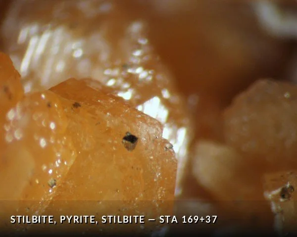
Open cavities in fault zone (N35°E, 68°NW) through amphibolite in garnet schist containing deep orange stilbite. The stilbite occurs in cavities a few cm in size as rounded sheaf-like clusters. Micro-scale pyrite cubes coat the stilbite. Some late-stage clear acicular stilbite blades occur locally. Collected 1/12/99.
Station 188+86LW4 images
Stilbite in sheaf-like crystal shapes at contact of pegmatite and biotite-chlorite schist. Another pocket located next to another pegmatite at 188+96, LW. Late plates of pyrite are found intergrown at late stages of stilbite mineralization. Collected 1/2/99 from conveyor belt during flooding incident and related 800’ conveyor walk-in.
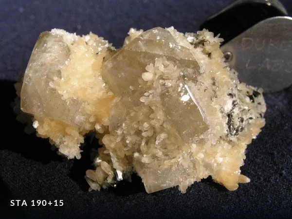
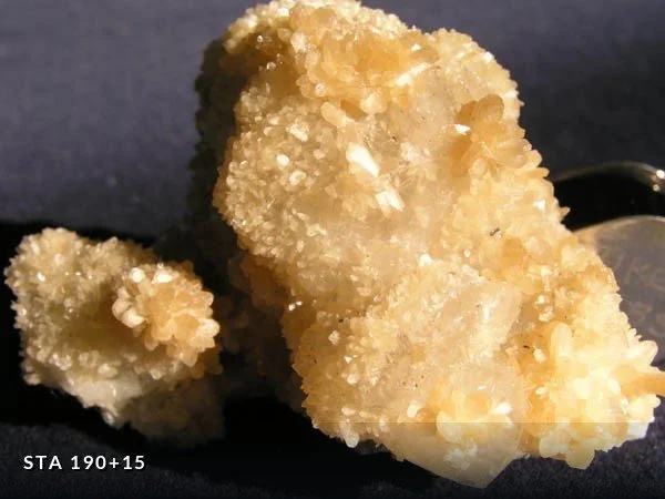
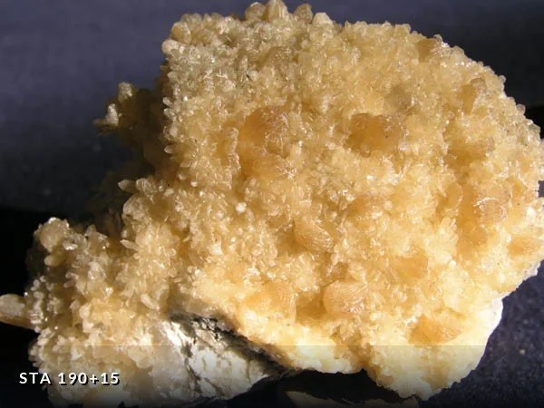
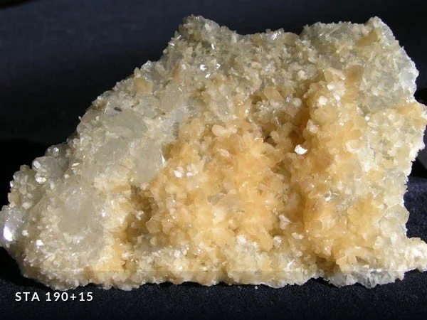
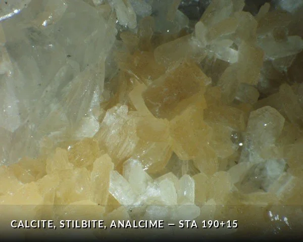
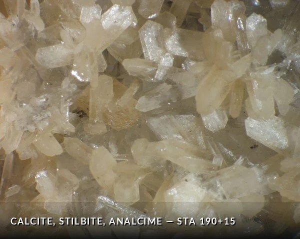
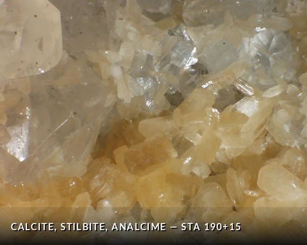
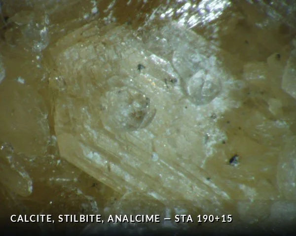
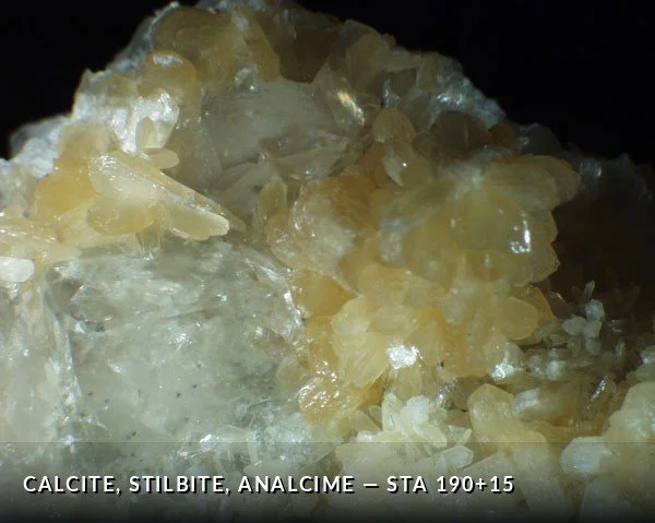
Station 190+15RW54 images
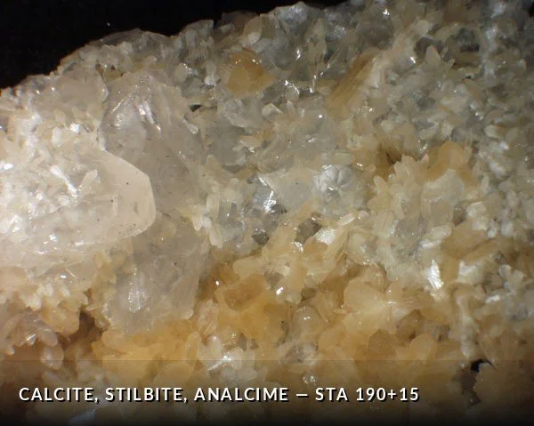
Light yellow crystalline stilbite crystals occur in gouge-rich fractured pegmatite. The stilbite crystals are overgrown on massive calcite. Two generations of small, clear crystals (apophyllite and younger analcime are predicted based on crystal shape) occur next. The analcime crystals are particularly striking because of their facet reflections and clarity. Locally, cm-scale pseudo-cubic calcite crystals are found to overgrow the crystallized matrix. Collected 1/20/99 and 6/7/99.
Station 190+52RW8 images
Clear interpenetrating calcite crystals about 1 cm in size in N11°E, 67°NW fault zone overgrow stilbite. Stilbite crystals form a basal substrate found overgrown with massive stilbite then the calcite. Late pyrite cubes here overgrow a second generation of clear stilbite blades. Collected 6/7/99.
Station 210+12RW6 images
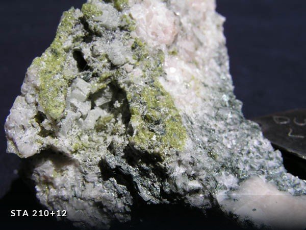
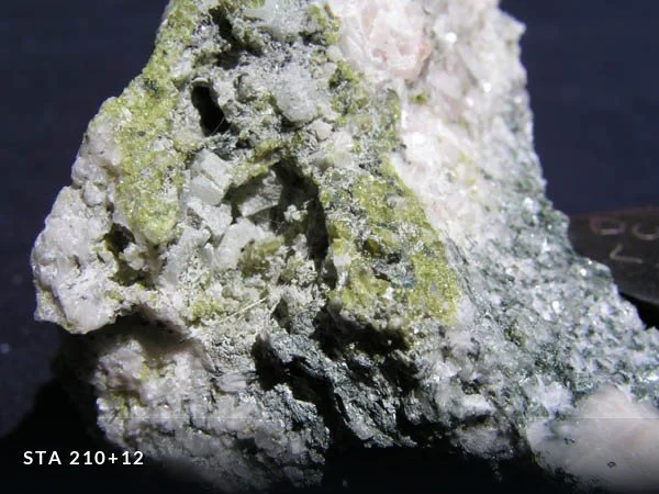
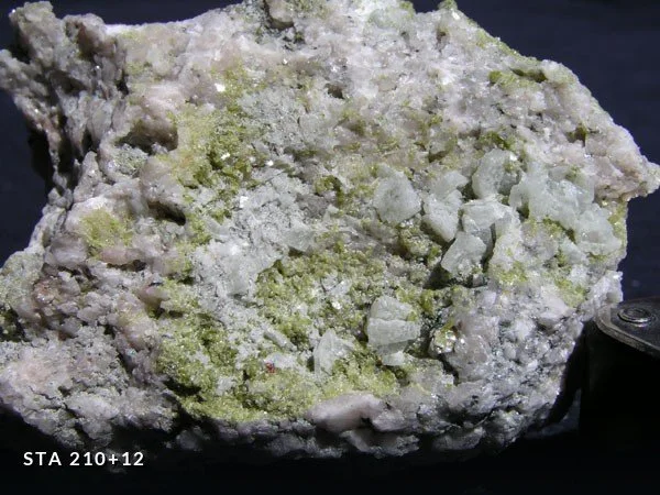
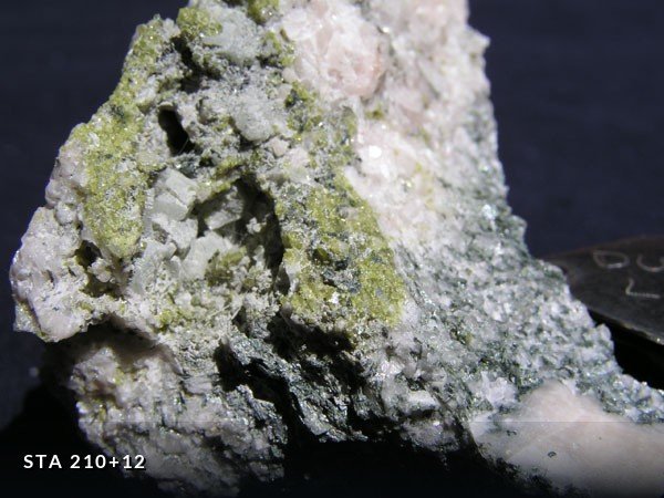
Pegmatite matrix with openings containing microcrystalline epidote and chlorite, 4 mm tabular pink apophyllite(?), sphalerite, and stilbite. Collected 6/15/99.
Station 214+25LW6 images
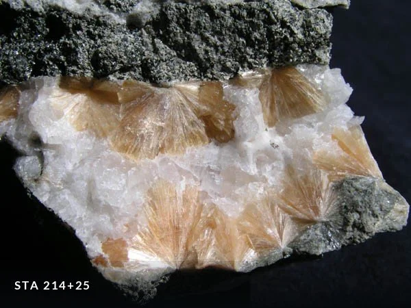
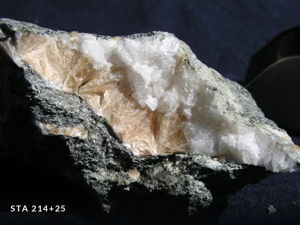
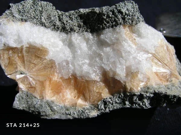
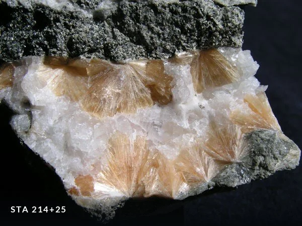
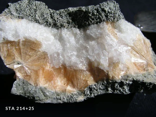
Radiating masses of orange-colored stilbite surrounded by white calcite in fracture fillings related to a fault oriented N29°E, 72°SE. The fault, which cuts mafic gneiss, has produced a crush breccia zone up to 3 m wide. Mineralization is found in thin veins a few mm thick to irregular nodules up to 10 cm long, all within the brittle fault fabric. Collected 6/16/99.
The Queens Tunnel holed through on 29 October 1999. The rock faces described here no longer exist; the tunnel has been lined, and the exposures that produced these specimens were visible for days at most. What survives is the record.